Earthquake Studies Office
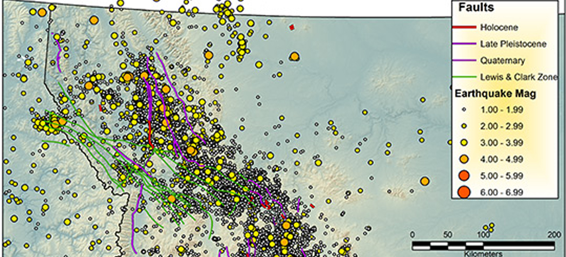
The Earthquake Studies Office (ESO) of the Montana Bureau of Mines and Geology (MBMG) operates the Montana Regional Seismic Network (MRSN), a network of 50 permanent seismic stations located throughout western Montana. The data from these 50 sensors are continuously sent to the ESO—using radio, satellite, cell phone links, and the internet—for recording and analysis. Using data from these stations, along with data from seismograph stations operated by other institutions, MBMG personnel determine the locations and magnitudes of local and regional seismic events, and determine whether they are earthquakes or man-made blasts at mines, quarries, or construction sites. Local and regional earthquakes (exclusive of Yellowstone, which the University of Utah Seismograph Stations monitors), along with local blasts, are contributed to the USGS Comprehensive Catalog. All seismograph station data are archived at the IRIS Data Management Center. The ESO typically records and locates about 10 (usually small) earthquakes each day in the northern Rocky Mountain region, but the actual number can be much higher during earthquake swarms or aftershock sequences. Since its beginning in 1982, the MRSN earthquake catalog includes more than 45,800 local and regional earthquakes.
The MBMG earthquake database is updated every evening.
To see all recent and historical earthquakes in Montana, check our
GIS Data Hub.
For real-time earthquake activity and events with magnitude 2.5 and larger, visitors should be directed to the USGS Earthquake the USGS Earthquake Search Catalog.
Did You Feel It? Report a felt earthquake to the USGS!
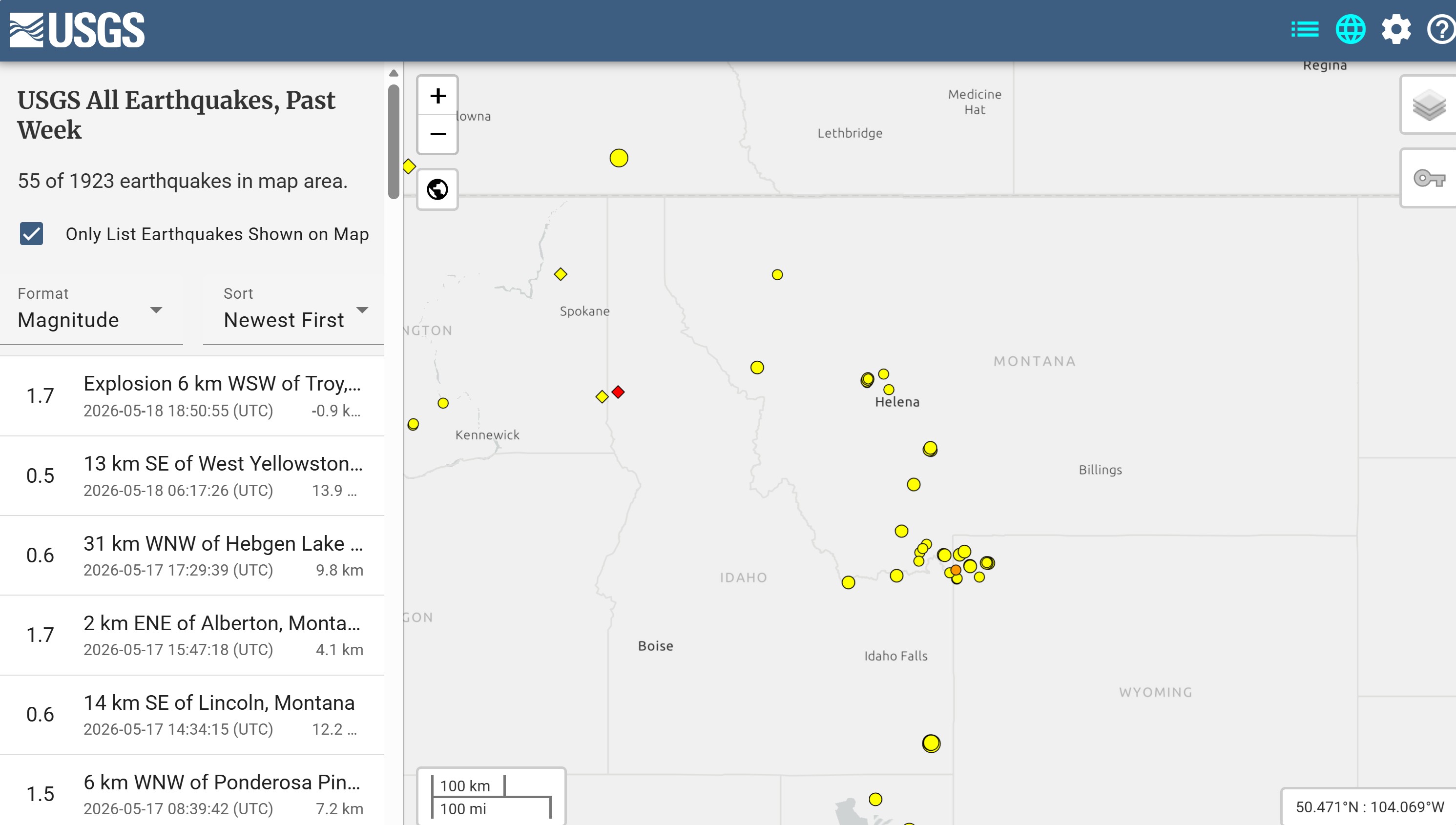
Recent seismic events listed on the USGS earthquake page, including those contributed by the ESO.
Seismic recordings from "Webicorders" for the Montana network and other selected seismic stations, and the history of the stations.
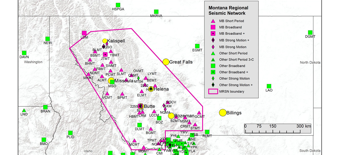
A map showing the location of all seismograph stations used to locate Montana seismicity and a listing of Montana Regional Network Station names, codes, locations, and opening dates.