Geohazards
The MBMG Geohazards Program has a mission to catalog, assess, and monitor geologic hazards across the State of Montana. The Geohazards Program strives to provide information on active faults, earthquakes, and landslides, and makes these data available to the scientific community, policy makers, and the public.
Active faults
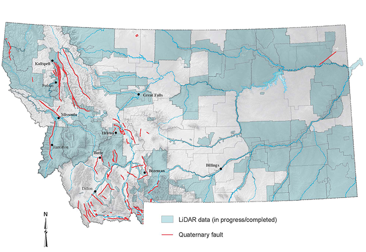
The MBMG provides research and information on Montana’s active faults that demonstrate fault activity during recent geologic time (Quaternary faults) and have the potential to generate damaging earthquakes.
Earthquake Studies
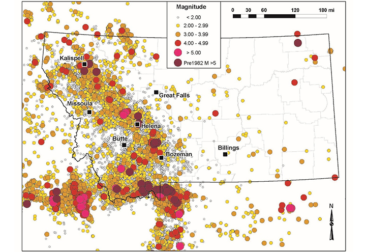
The Earthquake Studies Office monitors, analyzes, and reports on Montana earthquakes and makes these data available to the scientific community and the public.
Landslides
The Landslide Hazards Program aims to identify, map, and categorize landslide areas across the State of Montana.
Related Publications
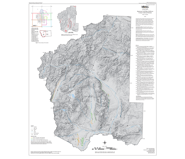
Montana Geologic Map 102
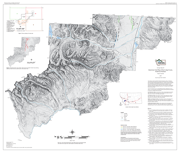
Gavillot, Yann G., 2025, Quaternary fault map of Deer Lodge County, southwest Montana.
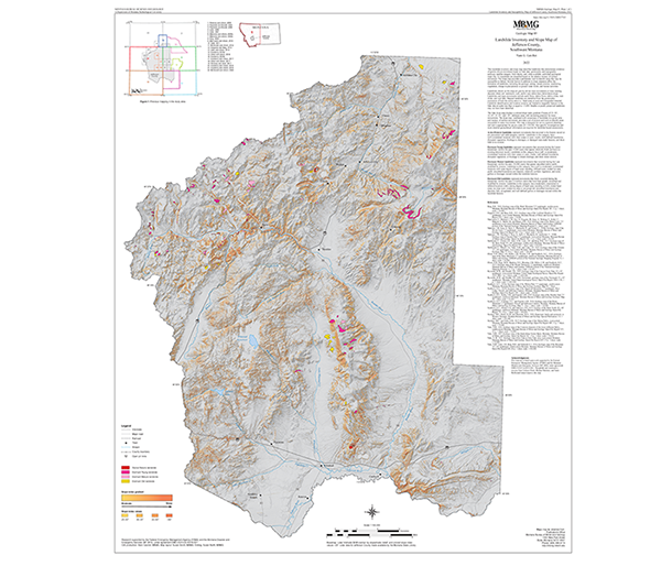
Montana Geologic Map 104
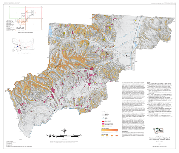
Gavillot, Yann G., 2025, Landslide inventory and slope map of Deer Lodge County, southwest Montana.
Bulletin 142
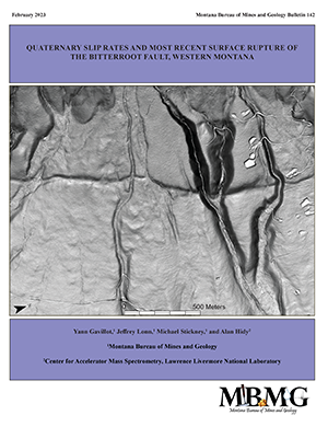
Gavillot, Y.G., Lonn, J., Stickney, M., and Hidy, A., 2023, Late Quaternary slip rates and most recent surface rupture of the Bitterroot fault, western Montana.
Geologic Map 83
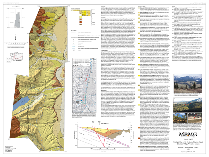
Lonn, J.D. and Gavillot, Y.G, 2022, Geologic map of the southern Bitterroot fault, Bitterroot Valley, western Montana: Montana Bureau of Mines and Geology Geologic Map 83.
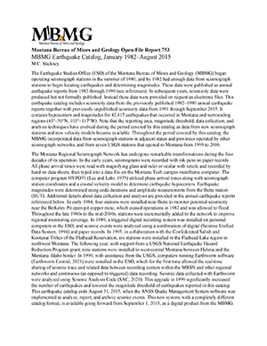
Special Publication 122
Stickney, Michael C., 2022, Earthquakes and seismographic monitoring in Montana, in Metesh, J.J., and Gammons, C.H., eds., Geology of Montana-Special Topics.
Geologic Map 85
Gavillot, Y.G., 2022, Landslide inventory and slope map of Jefferson County, southwest Montana.
Montana Geohazards Workshops
2025 Montana Geohazards Workshop
The Montana Bureau of Mines and Geology (MBMG) organized the 2025 Montana Geohazards Workshop held at the Flathead Valley Community College, Arts and Technology Center, 745 Grandview Drive, Kalispell, MT May 8-9, 2025. See agenda for more information.
2024 Montana Geohazards Workshop
The Montana Bureau of Mines and Geology (MBMG) is organizing the 2024 Montana Geohazards Workshop to be held in partnership with the Missoula Disaster and Emergency Services office at the University Center, Room 330/331, University of Montana, in Missoula May 1-2, 2024. See agenda for more information.
2023 Montana Geohazards Workshop
The Montana Bureau of Mines and Geology (MBMG) organized the 2023 Montana Geohazards Workshop held by the Disaster and Emergency Services office in Fort Harrison on April 26-27, 2023. In addition, FEMA training courses were provided following the workshop in Fort Harrison on April 27-28, 2023.
See agenda and directions for more information.
2022 Montana Geohazards Workshop
The Montana Bureau of Mines and Geology (MBMG) at Montana Tech hosted the Montana Geohazards Workshop on April 28, 2022.
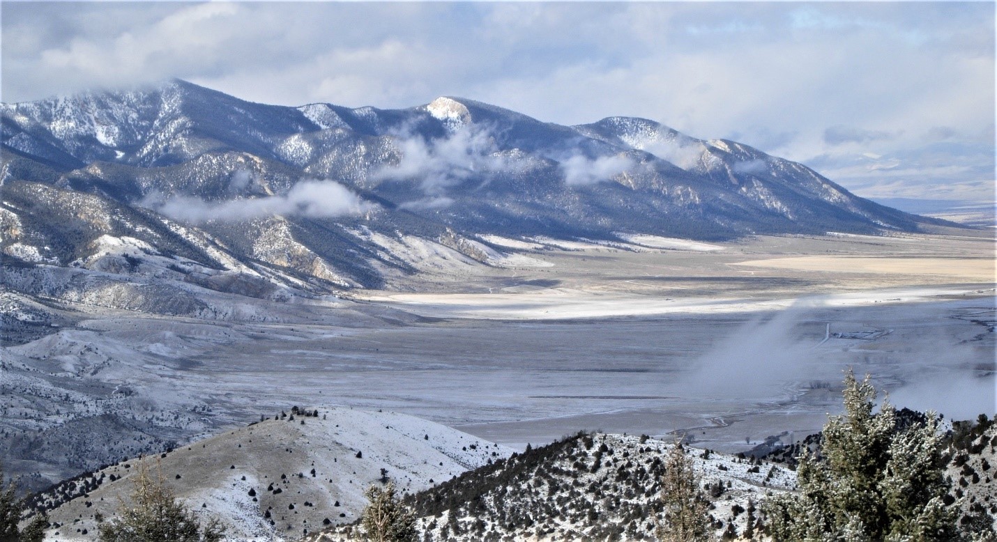
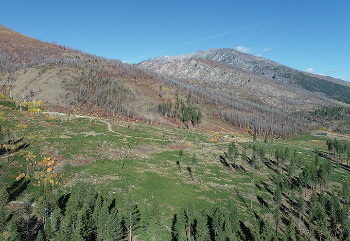
Ruby Range Northern Border Fault near Sheridan
Photo by Mike Stickney
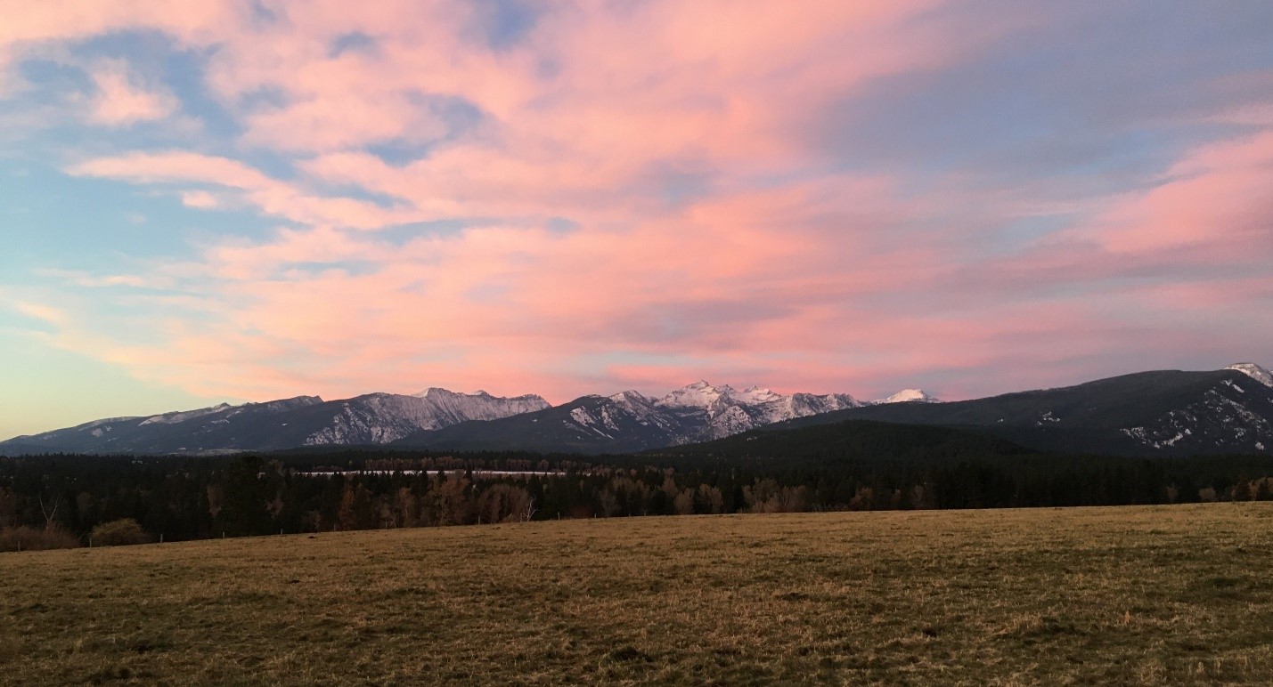
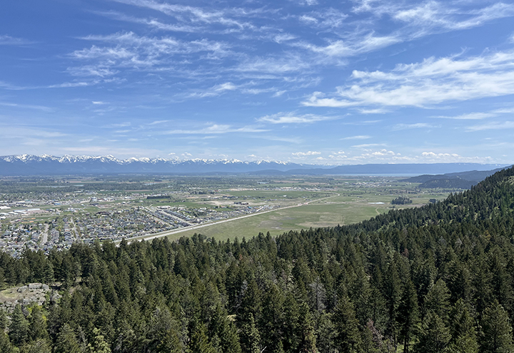
Bitterroot fault and Bitterroot Mountains near Hamilton-Missoula
Photo by Yann Gavillot
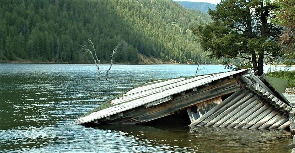
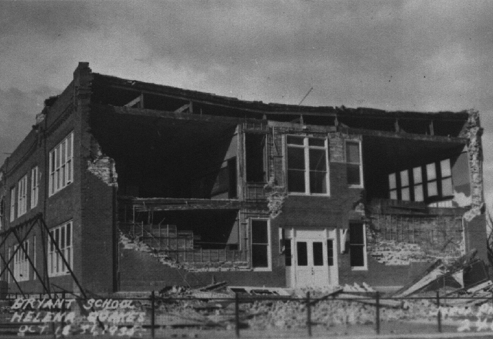
Site of building destruction during the 1959 Mw 7.3 Hebgen Lake earthquake, Gallatin National Forest
Photo by Mike Stickney