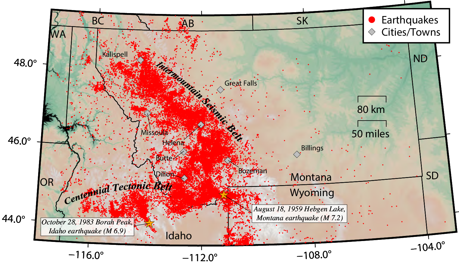
A belt of seismicity known as the Intermountain Seismic Belt extends through western Montana, from the Flathead Lake region in the northwest corner of the State to the Yellowstone National Park region where the borders of Montana, Idaho, and Wyoming meet. The Intermountain Seismic Belt continues southward through Yellowstone Park, along the Idaho-Wyoming border, through Utah, and into southern Nevada. In western Montana, the Intermountain Seismic Belt is up to 100 km wide. A branch of the Intermountain Seismic Belt extends west from the northwest corner of Yellowstone Park, through southwestern Montana, into central Idaho. This so-called Centennial Tectonic Belt includes at least eight major active faults and has been the site of the two largest historic earthquakes in the northern Rocky Mountains, the August 18, 1959 Hebgen Lake, Montana earthquake (M 7.2), and the October 28, 1983 Borah Peak, Idaho earthquake (M 6.9). Small earthquakes are common in Montana, occurring at an average rate of 7–10 per day.