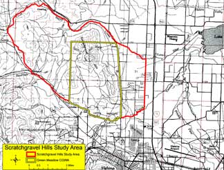
Scratchgravel Hills (Helena)
 Background and Purpose
Proposed subdivisions in the Scratchgravel Hills have caused concern about how much development can occur, how densely homes can be spaced, and if restrictions on water usage are needed. Elevated nitrate levels have been seen in some wells, creating concerns about the use of individual septic systems in this area of thin soils and shallow fractured bedrock. These concerns resulted in the designation of the Green Meadow Temporary Controlled Groundwater Areas (CGWA) in April 2008.
Project Scope
- An improved understanding of the geologic setting, aquifer properties, aquifer recharge, and aquifer discharge is being obtained through the collection of detailed hydrogeologic data.
- Monitoring of water levels has allowed the potentiometric surface to be better defined. Aquifer tests and water chemistry are being used to define aquifer properties, the degree to which aquifers are connected, and to evaluate water quality patterns.
- A numerical model of groundwater flow has been developed using these data. This model can be used to evaluate the impacts from various development scenarios.
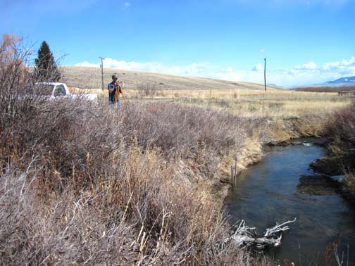
Andy Bobst prepares to determine relative elevations of a staff gage and piezometer near Sevenmile Creek
Project Factsheet — Aug 2011 (pdf file)
Presentations:
- Slide show presented at the 2014 Nitrate in Montana Conference, April. 23, 2014:
Sources of Nitrate in Groundwater in the North Hills and Scratchgravel Hills (pdf file) - Slide show presented at a Public Meeting, October 12, 2011 at UM Helena:
Scratchgravel Hills Update (pdf file)
Project Reports:
- Interpretive Report: MBMG 636 — Hydrogeologic investigation of the Scratchgravel Hills Study Area, Lewis and Clark County Montana
- Model Report: MBMG 643 — Hydrogeologic investigation of the Scratchgravel Hills Study Area,
Lewis and Clark County, Montana: Groundwater Modeling Report
- Technical Report: MBMG 646 — Hydrogeologic investigation of the Scratchgravel Hills Study Area, Lewis and Clark County, Montana: Technical Report
Project Data available here:
http://mbmggwic.mtech.edu/sqlserver/v11/menus/menuProject.asp?mygroup= &myroot=BWIPSG&ord=1&
Project Duration: July 2009 to June 2011
GWIP Personnel Assigned:
Andrew Bobst — Project Manager/Hydrogeologist
406.496.4409
![]() ABobst@mtech.edu
ABobst@mtech.edu
Julie A. Butler — Hydrogeologist/Groundwater Modeler
Kirk Waren — Hydrogeologist
406.496.4866
![]() KWaren@mtech.edu
KWaren@mtech.edu
Jane Madison — Professional Scientist
James Swierc, Lewis and Clark County Water Quality Protection District, Helena, MT
406.457.8585
![]() jswierc@co.lewis-clark.mt.us
jswierc@co.lewis-clark.mt.us
Contact information :
- Where to find us in Butte and Billings
- for general GWIP program information
 Ginette Abdo
or 406.496.4152
- for general MBMG information
Cathy McKillips
or 406.496.4167