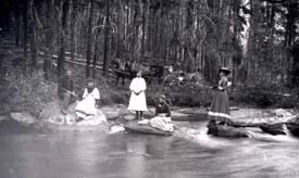
Lolo Creek
Background and Purpose
The purpose of this project is to investigate the cause of dewatering in the lower reach of Lolo Creek. Possible causes include residential development in the town of Lolo, water use by irrigators (within or beyond allocated water rights), Lolo Creek responding to a lowered alluvial water level in the Bitterroot River valley, climate, or some other factor.
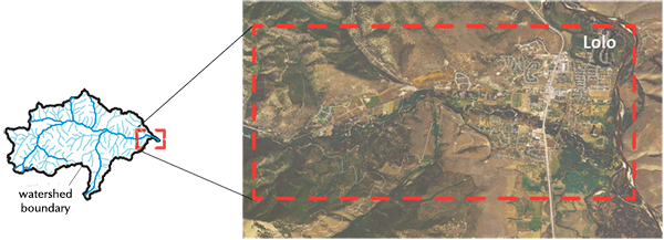
Local residents and landowners have noted that during some years the stream has become intermittent in the lower reaches, becoming disconnected with lower flow to river. Although there is anecdotal evidence that this has happened since the 1960s, frequency appears to have increased. This has been documented in the 1980s and again in 2007, 2011, 2013, and 2015.
Lolo Creek provides Bull Trout habitat and has historically been a productive fishery and water resource for the entire perennial reach from above Lolo Hot Spring all the way to the Bitterroot River. Groundwater and surface-water use included ditch diversions and subsequent irrigation, groundwater withdrawal through increasing number of private wells and public water supply discharges to meet development.
Project Scope
Tasks:
- In conjunction with DNRC, monitor stream flow at multiple sites
- Monitor groundwater levels within the study area
- Map gaining and losing reaches of the creek, document timing
- Evaluate historic and current groundwater-level trends as they relate to land-use changes in the area and climate
Products:
- A detailed report that outlines the study results and provides interpretations and recommendations
- A detailed watershed model that allows manipulation of groundwater and surface water parameters to predict results to Lolo Creek flow
- A data set of groundwater and surface-water levels and water-quality results available to the public through the MBMG Data Center
Project Duration:
Start up: May 2016, expected to be completed during 2018
GWIP Personnel Assigned:
Camela Carstarphen, Hydrogeologist
406.496.4633
 ccarstarphen@mtech.edu
John Wheaton, Senior Hydrogeologist
406.272.1603
jwheaton@mtech.edu
Ali Gebril, Hydrogeologist
406.496.4795
agebril@mtech.edu
Mike Chambers, Graduate student, Montana Tech
mchambers@mtech.edu
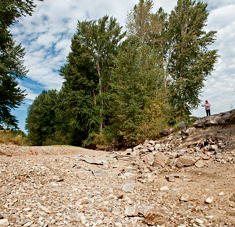
Lolo Creek during 2013
Project Factsheet: June 2016(pdf)
Project Updates:
Update of Factsheet May 2017(pdf)
Presentations:
- Lolo Creek Project, How Does a Stream Go from Wet to Dry — Poster presented to AWRA, October 2016, Camela Carstarphen, John Wheaton, Mike Chambers, and Ali Gebril
- Poster presented April 2016 Lolo Watershed Fair
Project Reports: (none yet available)
Project data available here:
http://mbmggwic.mtech.edu/sqlserver/v11/menus/menuProject.asp?mygroup=GWIP&myroot=BWIPLO&ord=1&
Contact information :
- Where to find us in Butte and Billings
- for general GWIP program information
Ginette Abdo
or 406.496.4152
- for general MBMG information
Bette Wasik
or 406.496.4167