Four Corners – near Bozeman
Background and Purpose
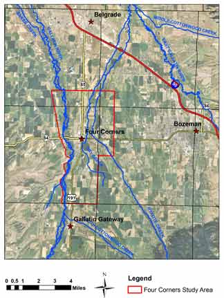 Subdivisions, rural residential, and commercial development are transforming agricultural land in the area of this busy community four miles west of Bozeman. Commercial water distribution and wastewater treatment systems are replacing irrigated land and traditional well and septic systems. The possible hydrologic effects of land-use conversion from irrigated agriculture to high-density residential have raised questions concerning both water quality and water availability.
New neighborhoods, utilizing both on-site septic systems and community wastewater systems, are replacing agricultural land around Four Corners. To assist in the appropriate management of water resources in this area, it is important to identify groundwater flow directions (including both horizontal and vertical gradients) and the hydrologic relationship between the aquifer and the river.
Project Scope
In order to provide more accurate descriptions of the geology, hydrologic properties of the aquifers, available water supplies, and the effects of stresses on the groundwater and surface water in the Four Corners area, GWIP has monitored over 35 surface-water locations along the West Gallatin and major tributaries and 60 wells. The main objectives of the Four Corners investigation are to:
- Determine the extent of alteration to the groundwater system in the Four Corners area over the past 60 years
- Examine groundwater changes as it relates to land-use conversion
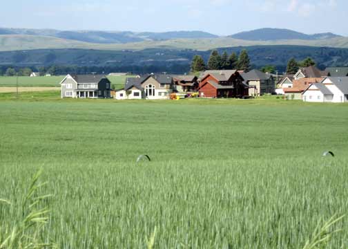
Elk Grove Subdivision near Four Corners. Wheel-line irrigation in foreground.
Project Duration: November 2009 to February 2013
GWIP Personnel Assigned:
Tom Michalek – Project Manager/Hydrogeologist
406.496.4405
![]() tmichalek@mtech.edu
tmichalek@mtech.edu
Mary Sutherland – Groundwater Modeler/Hydrogeologist
406.496.4410
![]() msutherland@mtech.edu
msutherland@mtech.edu
Project Factsheet (pdf file)
Recent Presentations:
- Slide show presented at the 2014 Spring Water Meeting, April. 9, 2014:
(2014SpringWaterMeeting_Gallatin.pdf) - Slide show presented to the Water Policy Interim Committee, Sept. 11, 2012:
(Four_Corners_Project_Update.pdf) - Presentation to Association of Gallatin Area Irrigators, December 2012
Publications and Reports:
- MBMG 652 — Hydrogeologic Investigation of the Four Corners Study Area, Gallatin County, Montana, Groundwater Modeliing Report
Project data available here:
http://mbmggwic.mtech.edu/sqlserver/v11/menus/menuProject.asp?mygroup=GWIP&myroot=BWIP4C&ord=1&
In the News:
![]() Investigating Groundwater in Montana Informs State Water Policy Decisions — Published 21 February 2016
Investigating Groundwater in Montana Informs State Water Policy Decisions — Published 21 February 2016
- Document the effects of irrigation and canal leakage on groundwater recharge
- Evaluate likely effects of future changes and development
- Map aquifer physical characteristics
- Collaborate with the Gallatin Local Water Quality District, other local agencies, and water users
- Create a numeric groundwater model of the Four Corners area to identify specific issues related to land-use conversion and the changing groundwater system
Contact information :
- Where to find us in Butte and Billings
- for general GWIP program information
 Ginette Abdo
or 406.496.4152 - for general MBMG information
Cathy McKillips
or 406.496.4167