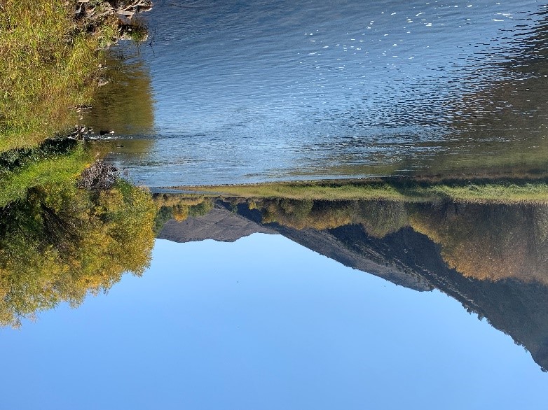
Lower Big Hole River, Beaverhead and Madison Counties

Background
The Big Hole River is a blue-ribbon trout fishery and an important water resource for the Glen area agricultural economy. Low river flows are detrimental for both agriculture and the fishery, decreasing the amount of water available for irrigation. Coupled with high water temperatures, low flows may trigger partial or full river fishing closure by wildlife management officials.
In response to these challenges, changes to irrigation practice and/or improvements to conveyance and diversion infrastructure have occurred or may be planned with the goal of using water more efficiently. However, these changes may alter aquifer recharge and affect interaction between groundwater and the Big Hole River.
Purpose
The purpose of this project is to utilize a combination of monitoring data and modeling to develop a water budget for the Glen area. This water budget and associated data will be used to estimate potential changes in temperature and quantity of the surface and groundwater resources associated with irrigation conversions and other irrigation infrastructure improvements/changes. Information from this project will be used to inform planning of irrigation infrastructure improvements/changes.
Project Scope
Objectives of this project include:
1) develop an updated conceptual hydrogeologic model,
2) develop a current baseline water budget for the Glen area,
3) characterize temperature variations in groundwater and surface waters,
4) construct models for prospective modeling scenarios.
Project Status
Field data collection concluded in November 2024. Data interpretation and an interpretive report are currently underway with a numerical groundwater model in development.
Project Reports
- An approach for Identifying River Reaches Sensitive to Warming from Daily Solar Radiation, Hydrological Processes v. 39, e70334 (Hanson, A.E.H. and Dohman, J.M., 2025)
View Report - Temperature and site data for groundwater seeps, tributaries, and tailwater returns to the Big Hole River (Hanson, A.E.H., and Dohman, J.M., 2025)
View Report - Analyses of three constant-rate aquifer tests in the lower Big Hole watershed near Glen (Dohman, J.M., and Myse, T., 2025)
View Report - Information Pamphlet – Groundwater inputs to rivers and streams: Using temperature and visual cues on the Big Hole River, southwestern Montana (Dohman, J.M, and Hanson, A.E.H., 2024)
View Report - Lower Big Hole Fact Sheet: August 2022
View Report
Project Personnel
| Mary Sutherland | Project Lead, Associate Research Hydrogeologist |
| Jenna Dohman | Assistant Research Hydrogeologist |
| Ann Hanson | Assistant Research Hydrogeologist |
| Todd Myse | Associate Research Hydrogeologist |
| Tyler Storey | Professional Scientist Research Hydrogeologist |
| Cole Denver | Professional Scientist Research Hydrogeologist |
Presentations
- Investigating elevated temperatures on the Lower Big Hole River near Glen, MT. Presented at the University of Montana Western On The Rocks Seminar Series, Dillon, MT, January 1, 2025.
- Exploring Groundwater and Surface-Water Connections Using Temperature and Water Supply in the Big Hole River near Glen, MT. Presented at the Montana American Water Resources Association (AWRA), October 10, 2024.
- Groundwater Monitoring and Groundwater/Surface-water Interactions using Handheld Thermal Infrared Imagery Field Trip for the University of Montana Western, Dillon, MT, October 4, 2024.
- Field tour in the Glen area for the Water Policy Interim Committee, July 16, 2024.
- Investigation of Summer River Temperatures, Groundwater/Surface-Water Inputs, and Solar Radiation on the Lower Big Hole River. Presented at WaterSciCon24, St. Paul, MN, June 25, 2024.
- Investigation of hydrogeologic influences on water supply and temperature in the Big Hole River, southwestern MT. Presented at the Geological Society of America Joint Cordilleran and Rocky Mountain Section Meeting, Spokane, WA, May 16, 2024.
- Hydrogeologic Influences on Water Supply in the Big Hole River Near Glen, MT: Presented at the Montana Section AWRA meeting, Missoula, Montana, October 11, 2023.
- An Update on the Lower Big Hole Groundwater Investigation. Presentation at the Big Hole Watershed Committee Monthly Meeting, June 19, 2024.
View Presentation -
Link to Project Data
Data collected for this project can be accessed through the Ground Water Information Center (GWIC) database:
Download project data from GWIC
Program Resources
Contact Information
Program Information
Ginette Abdo, GWIP Manager
(406) 496-4152 | Email