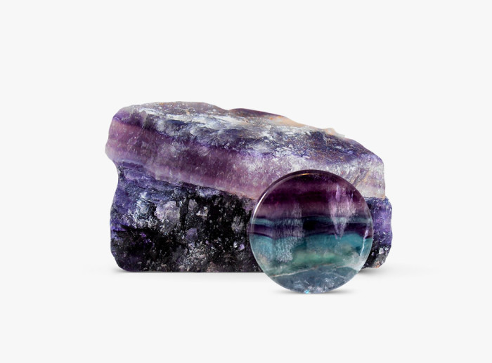
2019 Mining and Mineral Symposium October 9-11, 2019 Butte, Montana
The Mining and Mineral symposium, hosted by MBMG, focuses on topics related to economic geology, mineral deposits, mining and exploration, environmental issues, mining history, and geologic studies. Although topics tend to relate to Montana and the surrounding region, talks or posters from other locations are welcome.
Submit an abstract, extended abstract, or short paper by September 15th to:  kscarberry@mtech.edu or skorzeb@mtech.edu
FEATURED EVENTS
Wednesday, October 9th, 2019
Elkhorn Field Trip: Travel north of Butte to the Elkhorn mining district and examine gold skarn mineralization on and the remaining town of Elkhorn. Learn the area’s unique history and geology. There
will be opportunities to collect vesuvianite, axinite, and other minerals related to skarn deposits.
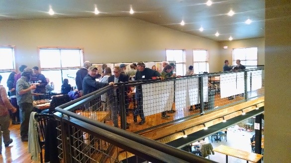
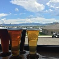
Informal Meet & Greet at the Butte Brewery after the field trip
Thursday, October 10th, 2019
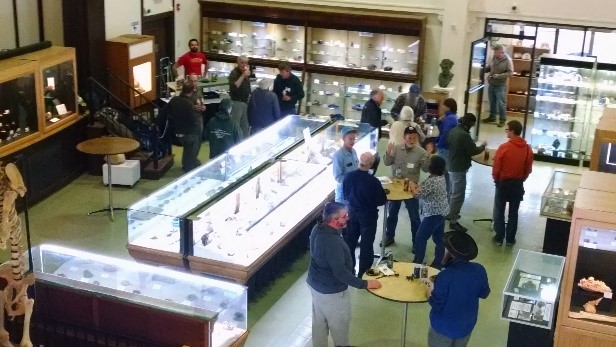
Oral presentations (including lunch) will be followed by a Poster Session at Montana Tech with a no host bar.
Friday, October 11th, 2019
Enjoy oral presentations, lunch (provided), and lab tours followed by an evening Map Chat at the Butte Brewery. Sample great beers from the Butte Brewing Company, meet our MBMG geologists, and learn about their current mapping projects. Bring your mineral samples and try to stump our geologists!
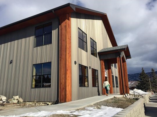
MONTANA TECH AND BUTTE BREWERY
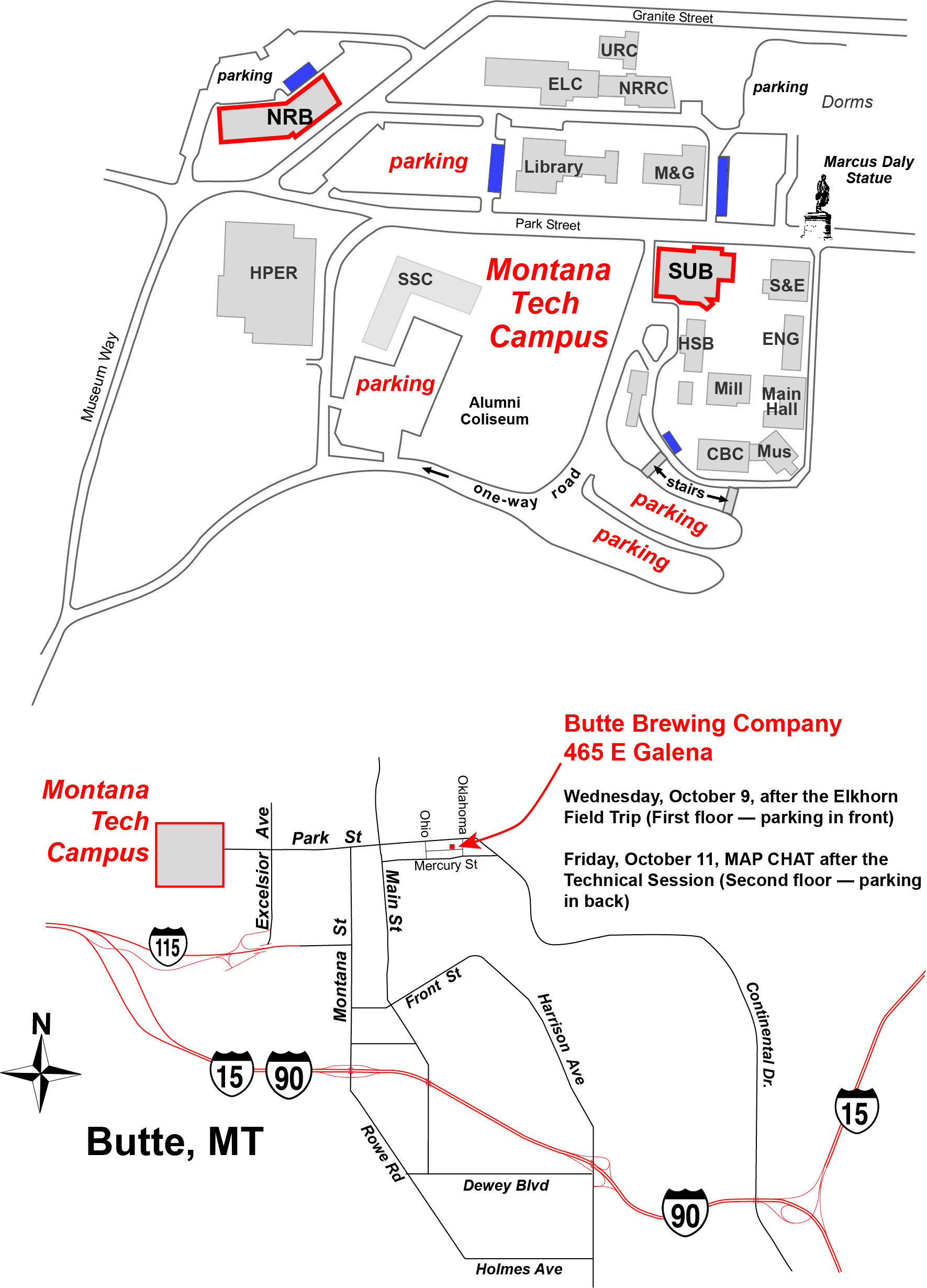
Agenda
MBMG MINING AND MINERAL SYMPOSIUM Butte, MT, October 9-11, 2019
October 9th WEDNESDAY - Elkhorn Field Trip
| 8:00 a.m.– 4:00 p.m. | Elkhorn Field Trip |
| 5:00 p.m.–7:00 p.m. | Meet and Greet at Butte Brewery |
October 10th THURSDAY - Copper Lounge, Student Union Building, MT Tech Campus
| 8:00 a.m.– 8:50 a.m. | Registration and Check-In |
| 8:50 a.m. – 9:00 a.m | Welcome, John Metesh, Director and State Geologist, Montana Bureau of Mines and Geology |
| 9:00 a.m. – 10:00 a.m. | Refining exploration strategies for geothermal systems in extensional settings: Lessons learned from the Great Basin region, western USA. , James Faulds, Director and State Geologist, NBMG – University of Nevada-Reno. |
| 10:00 a.m.– 10:30 a.m. | New Studies on the Oro Fino mining district, western Montana, Stanley Korzeb – Economic Geologist, MBMG – Montana Tech |
| 10:30a.m. - 11:00 a.m. | Coffee Break |
| 11:00 a.m. – 11:30 a.m. | Development and Implementation of Unmanned Aerial Vehicles for use in Mining Remediation, Ian Fairweather, Fairweather IT – Bozeman, MT |
| 11:30 a.m.– noon | Biology of waterfowl at the Berkeley Pit; Designing a protection plan for species diversity,,Stella Capoccia, Associate Professor, Biological Sciences, Montana Tech |
| Noon - 1:30 p.m. | Lunch Provided |
| 1:30 p.m. – 2:00 p.m. | Adventures in Recreational Prospecting in Montana , Alma Winberry, Central Montana Prospectors Coalition, Great Falls, MT |
| 2:00 p.m – 2:30 p.m. | Fluorescence of Montana sapphires,Bruce Cox – Missoula, MT |
| 2:30 p.m. – 3:00 p.m. | Montana’s Green Pipestone,Ted Antinoli – Missoula, MT |
| 3:00 p.m. – 3:30 p.m. | Mineralogy of Montana Iron Skarn Deposits, Mike Gobla, P.E., Denver, CO |
| 3:30 p.m. – 4:00 p.m. | Bull Mountain: Four Generations of Seekers, Pat Dawson – Boulder, MT |
| 4:00 p.m. – 4:30 p.m. | J.K. Pardee and the Silver Mining Era of Philipsburg, Montana, Anne Millbrooke – Bozeman, MT |
| 4:30 p.m. - 5:30 p.m | Poster Session/No Host Bar/Free Time (Big Butte Room, MTech SUB). |
October 11th FRIDAY - Copper Lounge, Student Union Building, MT Tech Campus
| 8:00 a.m.–8:50 a.m. | Registration and Check-In |
| 8:50 a.m. – 9:00 a.m. | Introduction, Comments and Announcements, , Kaleb Scarberry, MBMG – Montana Tech |
| 9:00 a.m. – 10:00 a.m. | Two-event genesis of Butte lode veins: geologic and geochronologic evidence from ore veins, dikes, and host plutons , Karen Lund, U.S. Geological Survey |
| 10:00 a.m.– 10:30 a.m. | The relationship of the Butte Main Stage fracture system to the Central Gray Sericite Zone, including location of the Leonard and horsetail ores, distribution of advanced argillic alteration, and the origin of the Main Stage fluids, Mark Reed, Professor, University of Oregon |
| 10:30a.m. - 11:00 a.m. | Coffee Break |
| 11:00 a.m.– 11:30 a.m. | Mineralogical investigation of the Sheep Creek Nb-REE carbonatite veins, southern Ravalli County, Montana, Chris Gammons, Professor, Geologic Engineering, Montana Tech |
| 11:30 a.m.– Noon | Antimony a strategic metal and USAC, John Lawrence, CEO U.S. Antimony Corp. – Thompson Falls, MT |
| Noon - 1:30 p.m. | Lunch Provided |
| 1:30 p.m. – 2:00 p.m. | New Developments at the Berkeley Pit and Yankee Doodle Tailings Impoundment.,Mark Thompson, Montana Resources – Butte, MT |
| 2:00 p.m – 2:30 p.m. | An update on the Black Butte Copper Project , Eric LeLacheur, Sandfire Resources – White Sulphur Springs, MT |
| 2:30 p.m. – 3:00 p.m. | Supporting the Transition to Deep Porphyry Copper Exploration: SHRIMP U/Pb Radiometric Dating of Titanite (CaTiSiO5) in the Distal and Superjacent Orbicular Alteration Zone of the Clementine Prospect, Southwest Montana, George Brimhall , President Clementine Exploration, Wis |
| 3:00 p.m. – 3:30 p.m. | Nature of the hydrothermal system at the Hog Heaven mine, northwestern Montana as revealed from ore mineralogy, fluid inclusions, and stable isotopes, Ian Kallio, M.S. Student Geologic Engineering , Montana Tech |
| 3:30 p.m. – 4:00 p.m. | Repurposing Tailings for Added Value, Matt Egloff , P.E. Civil Engineering, Montana Tech |
| 4:00 p.m. – 4:30 p.m. | Merging historical data with Google Earth and GIS, Tony Roth, Data Preservation, MBMG – Montana Tech |
| 5:00 p.m. – 7:30 p.m. | Map Chat and Pizza – Butte Brewing Company/No Host Bar/Pizza Provided |
Speakers
JAMES FAULDS
Jim Faulds is the Nevada State Geologist, Director of the Nevada Bureau of Mines and Geology (NBMG), and Professor at the University of Nevada, Reno (UNR). NBMG is a research and public service unit of UNR and is the state geological survey of Nevada. Faulds is a structural geologist with 30+ years of experience. He has been with UNR and NBMG since 1997, first as Professor and then serving as NBMG Director since 2012. He earned his B.S. at the University of Montana, M.S. at the University of Arizona, and Ph.D. at the University of New Mexico. He has studied crustal deformation in many parts of the world, including much of the western U.S., western Turkey, and New Zealand. His research has focused on how fault systems initiate and evolve through time. In recent years, he has been analyzing the structural controls and exploration strategies of geothermal systems in the western U.S., Turkey, New Zealand, and elsewhere. His geothermal journeys have included short-term appointments with the BRGM in France and both GNS Science and the University of Canterbury in New Zealand (as an Erskine Teaching Fellow) while on sabbaticals. He has published over 100 papers and dozens of geologic maps on extensional and strike-slip tectonics, as well as the structural controls on geothermal activity. He has also taught courses in structural geology, tectonics, geothermal exploration, and field geology, while serving as advisor for more than 25 graduate students.
STANLEY KORZEB
Stan is the Economic Geologist for the Montana Bureau of Mines and Geology since 2013 and held a variety of federal and industry positions over a period of 36 years. Prior to his present position, he was a VP of Exploration for Texas Rare Earth Resources for five years. Stan held a variety of contract exploration positions that included assisting with gold exploration projects in Venezuela and zinc exploration at the Pend Oreille mine, Metaline Falls WA. In addition, Stan held the position of Chief Geologist and Mining Engineer at the San Salvador mine located in Sierra Mojada, Mexico. Prior to his industry experience Stan was a project geologist at the U.S. Bureau of Mines for 15 years until the agency closed. His present research is focused on mineral deposit genesis and mineralogy. He earned a B.S. degree from the University of Massachusetts, Amherst, MA in 1975 and his M.S. degree from Miami University, Oxford, Ohio in 1977. Stan possesses an internationally recognized, professional registered geologist certification through the Society of Mining, Metallurgy, and Expiration.
IAN FAIRWEATHER
Ian Fairweather is President of Fairweather IT LLC (FIT), an Applied Science and Technology Consulting Company headquartered in Bozeman, MT. FIT’s major areas of focus are in Mining Remediation and Exploration. He has BS in Geology from the University of Montana (2000), and a MS in Geology/Geophysics from the University of Wyoming (2003). Ian’s primary area of expertise is Remote Sensing, with expertise collecting, processing, and interpreting hyperspectral, multispectral, thermal, radar, and lidar data sets. Ian and the team at FIT have pioneered the use of Unmanned Aerial Vehicles (UAVs) for use in mining remediation, including remote sensing surface cover type classification and remote collection of environmental samples. In partnership with Atlantic Richfield Company, FIT has invented a patent pending technology for remotely collecting water samples from flooded mining pits and other hazardous bodies of water.

STELLA COPPICIA
Stella Capoccia is an associate professor in the Department of Biology. Dr. Capoccia’s main research interests focus on human dimensions of wildlife management and the human-animal relationship. Her current research looks at trends in waterfowl migration and helping to develop an up-dated mitigation plan for the Berkeley Pit. Dr. Capoccia also studies the social dynamics of urban chickens and how that could result in exposure to disease. In the past, her field work included working toward the conservation of the Sonoran pronghorn in southern Arizona and brown and black bear conservation with Montana Fish, Wildlife & Parks. Dr. Capoccia has a strong background in animal geography, environmental policy, and political ecology. She received her Ph.D. in Geography from Rutgers University studying the political ecology of wildlife conservation in east Africa. Her Master’s Degree is in Environmental Policy from Clark University, where she studied urban wildlife policy. Dr. Capoccia’s Bachelor’s degree in biology served as the foundation for her graduate research and current position at Montana Tech.
ALMA WINBERRY
Born and raised in Great Falls, Montana graduating from Great Falls High School in 1964. Graduated from University of Montana in 1967 with a BS in anthropology and sociology. Taught school in Chicago, earning a Master’s degree in Special Education with behavior disorders. then moved back to Great Falls in 1975 teaching at the University of Great Falls and then as a resource consultant on the high line. Retired 2008 from teaching in the Great Falls Public Schools. Developed an art business and have done several local murals, public sculptures, and taught all kinds of art classes as my art studio for 10 years helping advertise other art facilities in Great Falls. In 2015 joined a prospecting club, then for the next 4 years traveled all over the state of Montana doing recreational prospecting.
BRUCE COX
Bruce Cox is a geological consultant wearing many hats. His work is focused on mineral exploration and mine geology, surface and underground geologic mapping, ore deposit structural controls, project generation and permitting. He has been collecting fluorescent minerals since the 1950s.
TED ANTONIOLI
Ted Antonioli is an exploration geologist focused on ore deposits in Western Montana and a little bit of Idaho.
MICHAEL J. GOBLA P.E.
Mr. Gobla is a geotechnical engineer with the Bureau of Reclamation in Denver, Colorado. He has degrees in mining engineering from the Colorado School of Mines and New Mexico Tech. His professional accomplishments include the design of major mine reclamation projects including the Summitville Mine in Colorado and the Gilt Edge Mine in South Dakota. For the past 40 years, Mike has been a mineral collector specializing in Montana mineralogy and mining history.
PAT DAWSON
As a student at Montana Tech, Patrick Dawson worked part-time, then full-time underground at the deepest mine in Butte, the Mountain Con. Financial support for his education was interrupted by the copper strike of 1967, resulting in his being drafted into the Army. He later attended Montana State University, where he was editor of the Exponent student newspaper. He worked a few years as State Reporter for the Billings Gazette before performing assignments in the Rocky Mountain West for TIME Magazine for 30 years. He is author of two non-fiction books.
ANNE MILLBROOKE
Anne Millbrooke grew up in western Washington. She went east to college, first to Boise State College in Idaho, then to the University of Wisconsin at Madison, and finally to the University of Pennsylvania in Philadelphia where she earned a doctorate in the history of science. She directed the Archive and Historical Resource Center at United Technologies Corporation. She taught history at universities in Alaska, Connecticut, and Montana, and online for Embry-Riddle Aeronautical University and the American Public University. She has received Smithsonian, National Science Foundation, and NASA fellowships. She is currently working on a biography of Joseph T. Pardee, a Montana miner who became a federal geologist and world famous for his glacial Lake Missoula research.
KAREN LUND
Karen is a senior research geologist in the Mineral Resources Program at U.S. Geological Survey. She earned B.S. in geology and in Russian language at University of Montana, M.S. in geology at University of Colorado, and Ph.D. in geology at The Pennsylvania State University. She worked 5 seasons in minerals exploration in Alaska and the mountain west before being hired by USGS. She has conducted numerous multidisciplinary mineral resource assessments across central Idaho, eastern Nevada, and the Boulder batholith, with emphasis on regional tectonic framework of mineral deposits. She has synthesized results into new models for the development of western Laurentia and its ore deposits.
MARK REED
Mark Reed has been a professor in the Department of Geological Sciences, University of Oregon from late 1979 until 2016 and he continues there now supervising graduate students, including one currently working on a Butte project. His research emphasizes characterization of hydrothermally altered rock, vein mineral assemblages and geothermal well water compositions, coupled with thermodynamics-based computer modeling of water-rock reactions. From early 1977 through late 1979, he worked for the Anaconda Company in Butte, mapping crosscuts and drill core from the Kelley and Steward mines and subsequently mapping core in the Butte Deep Drilling project, which he managed. He focused on seafloor hydrothermal systems for his PhD research at U.C. Berkeley, preceded by undergraduate majors in chemistry and geology from Carleton College.
CHRIS GAMMONS
Chris Gammons is a Professor in the Geological Engineering Department at Montana Tech. He earned his B.Sc. in Geology from Bates College in 1980 and his Ph.D. in Geochemistry and Mineralogy from Penn State University in 1988. His research focuses on Aqueous geochemistry at high and low temperatures, economic geology, acid mine drainage, and stable isotopes.
JOHN LAWRENCE
1957-1962. Worked for Shell Oil Company on Seismic Crew No. 54 in Wyoming and laboratory in Casper, Wyoming. Worked for Big Horn Drilling, Loffland Brothers, Falcon Seaboard, and R. L. Manning in Wyoming oil field drilling, Floors, motors, and derricks.
1960. Bachelor of Arts in geology and mineralogy Hamilton College with credits from the University of Wyoming.
1961. Masters degree in geology and mineralogy University of Wyoming.
1963. Completed all course work, written and dissertation for PhD’s degree, but never defended thesis that was published and sponsored by the Utah Geological Survey. Course work in geology, mineralogy, physical chemistry, mining engineering..
1964-1969, Mined copper open pit and underground at the Empire Mine, Mackay, Idaho and silver and gold from the Yankee Fork Mining District, Custer County, Idaho. Built and operated copper leach plant, flotation mill, and cyanide leach plant.
1969 UNTIL PRESENT. Founded United States Antimony Corporation. President and CEO. • 1969-1983. Mined antimony underground from 23 drifts at Thompson Falls, Montana. Built flotation mill and smelter. • 1983 UNTIL PRESENT. Operated Thompson Falls smelter on ore from China, Mexico, Europe, Bolivia, Peru, Alaska, Canada, and United States. This is the only significant antimony smelter left in the United States. • 1981-1989. Built and operated Preachers Cove flotation mill and Merrill Crowe leach plant. Mined Lucky-Boy, General Custer, Estes Mountain, and Red Bird Mines in central Idaho. • 1980-1984. Build and operated a placer gold operation in the Nine Mile Canyon west of Missoula, Montana • 1989-1999. Mined the Yellow Jacket Mine in Lehman County, Idaho. Built and operated a flotation mill. • 200-Present Founded the Bear River Zeolite Division of USAC. Constructed a 500 tpd crushing, screening, blending, and packaging plant that includes a 6058 Raymond mill. Open pit mine currently producing about 15,000 tpy. • 1985 to Present. Worked in Mexico, Bolivia, and Honduras. Built a 100 tpd gravity/flotation mill with a cyanide CIL circuit. Currently, it is being expanded to 500 tpd in Queretaro, Mexico. Built a smelter in Coahuila, Mexico with a capacity of 25t pd of concentrate. Currently producing about 1,000,000 ppy of antimony from the Wadley and Guadalupe mines underground. Production is increasing. Brining the Los Juarez open pit gold/silver/antimony mine into production Q4 2019. The deposit is 3.5 km long and up to 1 km in width. Deep seated jasperoid bulk mineable pipe. Constructed a precious metal refinery into production at Thompson Falls, Montana.
MARK THOMPSON
Mark Thompson earned a MS in Environmental Engineering from Montana Tech in 1996. Mark has worked at the Red Dog Mine in Alaska, the Golden Sunlight Mine in Whitehall, MT and currently is the Vice President of Environmental Affairs at Montana Resources in Butte, MT. Mark has been very active with the Montana Mining Association and has severed five years as President of that organization.
JERRY ZEIG (Presenter : Eric LeLacheur)
With a Masters of Science in Geology from the University of Montana, Jerry Zieg has over 35 years of mining exploration experience for copper, zinc, and precious metals in a variety of settings, countries and geography. He spent 24 years working for Cominco American Inc. (later Teck Cominco American Inc.), participating in the discovery of the Black Butte Copper deposits and lead the exploration team responsible for the Pend Orielle Mine resource expansion.
He joined NovaGold Inc. in 2005 managing their U.S. exploration programs in Alaska. In 2009, he helped start Tintina Resources Inc. to undertake exploration and development of the Black Butte Copper deposits.
Jerry grew up on ranch on the Smith River below Camp Baker. His family still lives near White Sulphur Springs and he owns a ranch in Meagher County. He and his wife Susan have two grown children. Jerry is a history buff who enjoys compiling local early history; he also enjoys traveling, golfing, reading, fly fishing and playing the guitar.
GEORGE BRIMHALL
George Brimhall now manages Clementine Exploration following professorships at The John Hopkins University (1976-1978) and UC Berkeley (1978-2011), with earlier employment with the Anaconda Company (1972-1976) as the Steward Mine Geologist and Project Geologist for exploration of the deep porphyry copper-molybdenum mineralization.He received the Lindgren Award of the Society of Economic Geology in 1980 for his research and exploration management of the Pre-Mainstage Cu-Mo mineralization at Butte. He was awarded the Noyce Prize for excellence in undergraduate teaching at UC Berkeley, and was elected to the National Academy of Engineering in 2001.
IAN KALLIO
Ian is a geology graduate student studying ore mineralogy, fluid inclusion and stable isotope of the Hog Heaven mineral deposit in northwestern Montana. He contributed to a 1:12,000 geologic mapping project centered about the mine site during the summer of 2019. He expects to graduate May 2020. Ian has strong interest in mineral exploration associated with continental arc magmatism and extension and hopes to pursue a career as an economic geologist.
MATT EGLOFF, PE
Mr. Egloff has MS degrees in Metallurgy (MT Tech 2016), Electrical Engineering (MSU Bozeman 1997), and Physics (MSU Bozeman 1993). He is currently working on a Ph.D. in Materials Science through MSU Bozeman. He has taught engineering at MT Tech from 2006 to the present. Prior to this he has worked for Resodyn, Semitool, Lucent, ILX Lightwave, and Scientific Materials. He has helped design everything from small instruments to industrial machinery to processing plants. Mr. Egloff is co-inventor on four patents related to automation controls and electro-chemical processing. He serves on several NFPA and Underwriters Laboratory committees responsible for developing numerous safety codes and standards. He also serves in the Fundamentals of Engineering Exam Other Disciplines committee, responsible for developing that FE exam for NCEES. Mr. Egloff is a Veteran, serves as Post Commander of American Legion Post 115 and as a trustee in VFW Post 1148 in Butte.

TONY ROTH
Tony Roth was born in Wiesbaden, West Germany and moved to Montana in 1971. Tony served in the U.S. Military from 1988 to 1992. He earned an A.A. degree in Internet Technology Networking from Montana Tech in 2014. Tony has worked in Data Preservation at MBMG since 2012 where his work has focused on archiving historic mine maps from Montana.
Talks
Refining exploration strategies for geothermal systems in extensional to transtensional settings: Lessons learned from the Great Basin region, western USA
James E. Faulds
Active extensional to transtensional tectonics have induced a high geothermal gradient and abundant geothermal resources in the Great Basin region of Nevada and adjoining states. Although the region currently hosts ~25 geothermal power plants with a capacity of ~720 MW, it has the potential to produce far greater amounts of energy. However, discovering new resources and subsequent development have faced various challenges, including locating sufficient permeability at depth. It is generally easier to find adequate temperature than permeability. Furthermore, most geothermal resources in this region are blind, with no surface hot springs or steam vents to guide exploration. It has long been known that faults are the primary control on geothermal systems in this region, but which types of faults are most conducive to geothermal activity had not been studied in much detail. Over about the past 10 years, we therefore embarked on a systematic program to first characterize the favorable structural settings of known geothermal systems and then synthesize that information with multiple other parameters to discover new blind geothermal systems.
In our characterization of favorable structural settings of ~250 known systems, we found that nearly 90% in the extensional Basin and Range province reside in step-overs (relay ramps) in normal faults, normal fault terminations, fault intersections, or accommodation zones. In the transtensional, western part of the Great Basin within and proximal to the Walker Lane, displacement transfer zones (where strike-slip faults end in arrays of normal faults) and pull-parts host many systems. High fault density in these settings facilitates high permeability and fluid flow. Mid segments of major normal faults are generally devoid of geothermal systems, probably due to reduced permeability in clay gouge and periodic stress release in major earthquakes. Step-overs, terminations, intersections, and accommodation zones are critically stressed areas, where fluid pathways more likely remain open due to breccia-dominated faults and more micro-seismicity.
These findings were incorporated into a play fairway analysis, whereby nine geologic, geophysical, and geochemical parameters were synthesized to produce a geothermal potential map of 96,000 km2 of Nevada. Parameters were grouped in subsets and weighted to delineate rankings for heat and local, intermediate, and regional scale permeability, which collectively defined likely areas for geothermal fluid flow or play fairways. Several features were used to assess permeability, including 1) structural settings, 2) the location, age, slip rates, and slip/dilation tendency of Quaternary faults, 3) geodetic strain rates, 4) horizontal gravity gradients, and 5) earthquake density. Dozens of prospective areas were identified. Two sites with particularly high potential were selected for temperature-gradient drilling, with results indicating discovery of two blind systems, validating the technique. A key lesson learned is that detailed geophysical surveys can play critical roles in identifying favorable structural settings to lower the risks of drilling in the many basins in the region.
New Studies on the Oro Fino Mining District, Deer Lodge County, Montana
Stanley L. Korzeb and Kaleb C. Scarberry
The Oro Fino mining district is located 6 miles east of Galen and extends south to the boundary between Deer Lodge and Silver Bow Counties. This investigation generated new and updated geologic data on the known mineral resources and assessed the future exploration potential for the district. New data was generated using advanced investigative techniques including stable isotope, trace element and whole rock geochemistry, geochronlogy, identifying alteration types, fluid inclusion studies, mineralogy, and cathodoluminescence analysis of quartz veins.
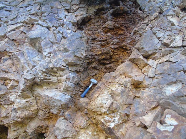
Oro Fino district veins are classified as epithermal low to intermediate sulfidation. The veins are hosted by the Butte Granite and developed during back arc magmatism that erupted the Eocene Lowland Creek volcanic field. Fluid inclusion, sulfur isotope, cathodoluminesence, and electron microprobe (EMP) analysis data along with alteration and vein mineralogy suggest the veins developed from a changing and evolving hydrothermal fluid. Fluid inclusion and sulfur isotope data imply the initial hydrothermal fluids had a magmatic source originating from a cooling pluton that followed Lowland Creek volcanism. The initial fluids evolved into low-salinity, low-temperature fluids through boiling and fluid mixing events. Sulfur isotopes show an enrichment in δ34S averaging 6.9‰ suggesting the hydrothermal fluids were influenced by crustal contamination. An inferred source for δ34S enrichment could be Proterozoic Belt Supergroup formations assimilated into a pluton which underlie the Boulder batholith. Fluid inclusion data suggest the veins exposed on the surface formed at a depth of 0.8 km and represent the lower section of an epithermal system. The veins have features of both low and intermediate sulfidation epithermal veins suggesting the hydrothermal fluids were sourced from an underlying or nearby porphyry system. The Oro Fino district and vicinity could be a future exploration target for a deep porphyry system. In addition, the variability of epithermal systems suggests the past producing mines and unexplored veins could be future exploration targets for additional silver-base metal resources.
Development and Implementation of Unmanned Aerial Vehicles for use in Mining Remediation
Ian S Fairweather,Fairweather IT LLC, Bozeman, MT, USA Jim Jonas,Fairweather IT LLC, Opportunity, MT, USA
Fairweather IT (FIT) has pioneered the use of Unmanned Aerial Vehicles UAV’s for various mining remediation work. UAVs are now used to safely collect data and environmental samples that were previously collected manually. Monitoring and sampling water filled mining pits for chemical analysis is a primary concern of liability managers and other stakeholders. Due to acidic pit waters and the geologic instability of pit walls, direct human water sampling is often not recommended or permitted. With the technological advent of UAVs, the FIT team has developed a multi-use unique flying platform capable of collecting water profile data and physically collecting in-situ water samples to depths greater than 446 ft. Our method uses a custom cross-UAV platform we have named WaSP (Water Sampling Platform) that can be connected to any high-payload (greater than 6 kg) multirotor UAV. FIT also has established methodologies utilizing specialized cameras and sensors for mapping and monitoring surface cover types of mining remediation sites. Thermal infrared, multispectral, and standard optical sensors are being employed to map and characterize the surface and topography of sites with thermal and radiometrically calibrated imagery at centimeter scale resolution. This is required when comparing multiple remotely sensed data sets collected over time.
Bird hazing at the Berkley Pit
Capoccia, Stella
Waterfowl migration is a difficult time for both birds and mining companies. Driven by ever-changing weather activity, birds’ pursuit stressful migration flights that result in unpredictable behavior and changes in flight patterns which challenge wildlife mitigation efforts. This research reports on the development of an advanced waterfowl protection plan at the Berkeley Pit, in Butte Montana. We estimate that over 40 bird species may use the Pit for seasonal/regional activity and are tracking site-specific preferences for this unique environment. We survey these species and their trends to understand how different species and weather patterns may enhance or detract from deterrent and hazing efforts. Our findings address climate trends, biodiversity, and avian biology as they relate to the area.
Adventures in Recreational Prospecting in Montana
Alma Winberry
Recreational prospecting in Montana has great appeal to the general public as it is an outdoor activity that the entire family can participate in and it is done without very little equipment investment, that’s if you know where to go. With such a big state and a very diverse landscape, if one wanted to do some recreational prospecting to find either gems, gold or fossils, where would you go to pursue your desire? That is where Central Montana Prospectors Coalition helps fulfill a need for the general public with ideas to engage with tried and tested sites on the internet so one could duplicate the adventure themselves in any direction. The pitfalls, opportunity and ideas put forth for four years now have become a good trend setter for strike outs all over. In this presentation you will find multiple ideas, places and experiences to enhance your recreational access to the huge resources our Montana outdoors has to offer from the dinosaur trail, to success with finding gold, or filling your gem and jewel case with beauties you have found yourself while treading Montana trails. Your friends visiting you from out of state will love your knowledge of possibilities here if you take them to some of these places cited. An elaborate delineation of museums, rock shops, gem and mineral shows, along with group digs or private land access opportunities abound with this presentation of years of prospecting experience in a wide range of activities and topics to be covered.
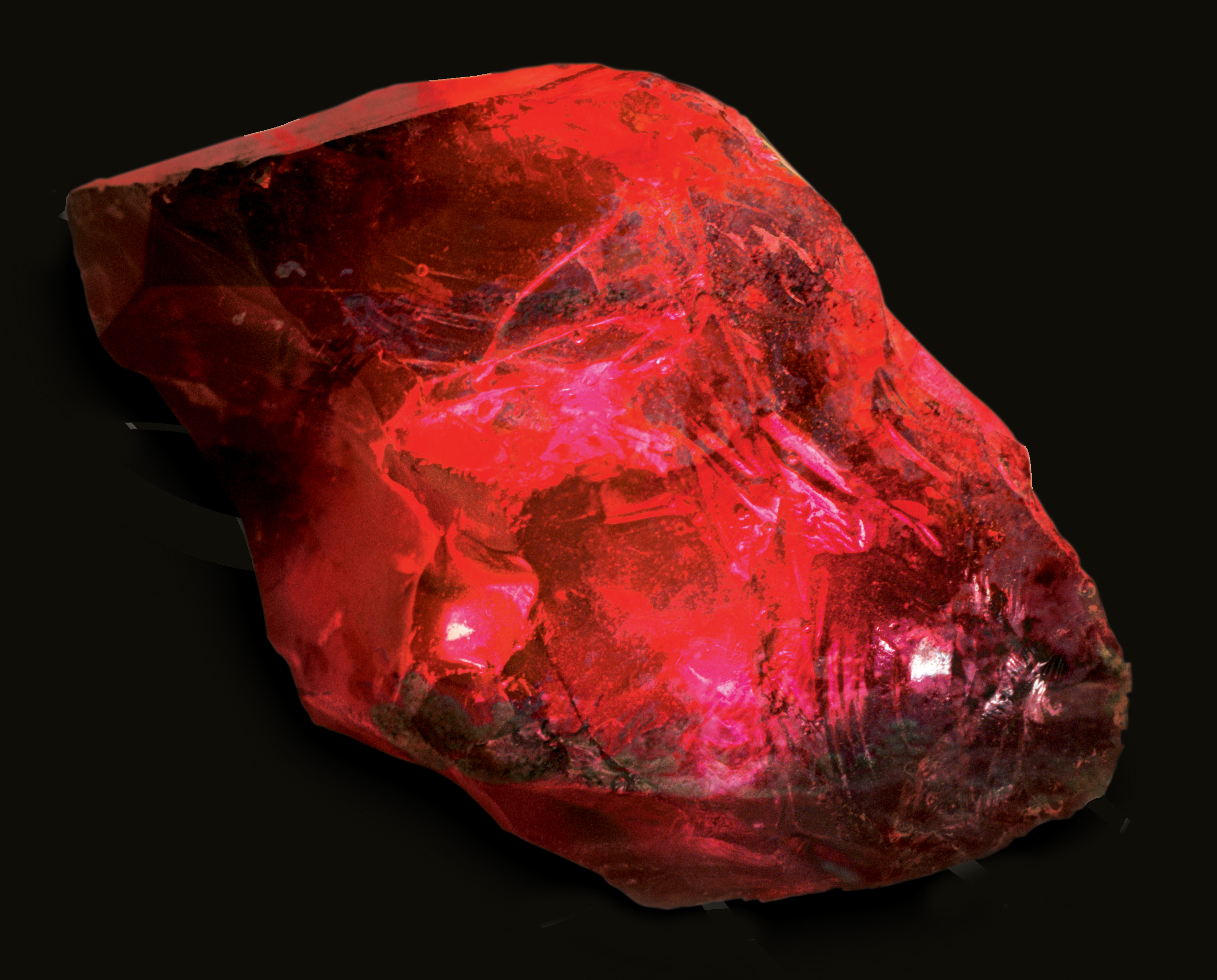
Fluorescence of Montana sapphires
Bruce Cox
Corundum commonly displays fluorescence when exposed to ultraviolet light. This phenomenon has been described in gemstones from mining districts worldwide and Montana sapphires are no exception. Sapphires from Montana’s four principal sapphire mining districts were examined using a binocular microscope under incident white and 365nm ultraviolet light sources. Specimens were graded for UV color and intensity and submitted to a commercial lab for heat treatment. Analytical results indicate a high intensity UV light source can be used to improve selection of stones from jig concentrates for heat treatment. UV lamps may also have application for recognition of sapphire bedrock source terrains.
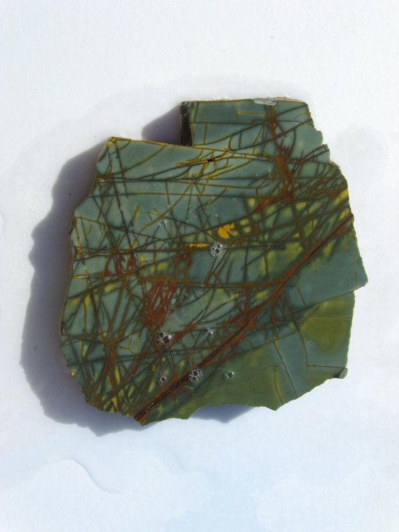
Montana’s Green Pipestone
Ted Antonioli,Contact Mining Company, 5907 Longview, Missoula, MT 59803
Text will come soon!!!
Mineralogy of Montana Iron Skarn Deposits
Mike Gobla
My presentation will explain what a skarn is, how they form and evolve, and will focus on the history and mineralogy of three skarns, the Rothfuss Iron Mine near Radersburg, the Pomeroy Mine near Georgetown, and the Cable Mine near Georgetown. I also will briefly mention all four of Montana's Ludwigite localities (Pomeroy, Redemption, Colorado Gulch, and Elkhorn with photos of specimens from the first three locations). The talk will end with the Cable mine in order to show the transition from a simple iron skarn to a more evolved one that is economically important for gold.
Bull Mountain: Four Generations of Seekers
Pat Dawson
Four Generations of Seekers chronicles how a pioneer family patriarch with a colorful past on the Western mining frontier left a legacy of unfinished prospects and restless curiosity for his descendants who utilize modern exploration methods and new geological information to search for precious minerals in Jefferson County.
Anne Millbrooke
Text will come soon !!!
Two-event genesis of Butte lode veins: geologic and geochronologic evidence from ore veins, dikes, and host plutons
K. Lund, R.J. McAleer, J.N. Aleinikoff
The long-standing ore-genesis model for world-class deposits of the Butte mining district, Montana, is of deep pre-Main Stage porphyry Cu-Mo and overlying Main Stage Ag-Zn-Cu zoned lode veins—formed from discrete hydrothermal systems related to rhyolite dikes. The lode-specific model describes metals zones that formed in the lode veins as hydrothermal processes diminished in intensity (changing temperature and chemical characteristics) outward from the district center. New geologic and multi-method geochronologic studies provide new timing constraints on the lode veins and re-evaluation of geologic relations (Lund and others, 2018), leading to a new model for formation of the lode veins and their relations to stockwork Cu-Mo deposits and igneous events.
Our geochronologic studies yield three major constraints. (1) Dates on samples of the Butte Granite country rock indicate that, after its emplacement at 76.9-Ma (SHRIMP U-Pb), it cooled relatively quickly to 350-400°C in <4 m.y. (40Ar/39Ar). (2) Dates on cross-cutting quartz porphyry rhyolite dikes (SHRIMP U-Pb) indicate that the five main dikes and a small stock were emplaced into the cooled Butte Granite at 67-65 Ma (ages overlap within uncertainty) as a single event; the youngest E-W rhyolite dike was emplaced at 60 Ma. Emplacement of the dikes did not sufficiently reheat the country rocks to reset host-rock 40Ar/39Ar ages beyond the meter scale. (3) 40Ar/39Ar ages were acquired for fifty-eight white mica and K-feldspar samples from alteration envelopes associated with lode veins across the district and at various depths. Ag-Au-polymetallic lode veins in outer parts of the district yield ages of 73-70 Ma, Zn plus Cu lodes in intermediate areas yield complex age spectra of 69-65 Ma, and Cu-rich lodes in the district center yield ages of 65-64 Ma.
Petrographic data for the dated minerals facilitate interpretation of the 40Ar/39Ar ages. Backscattered electron (BSE) and panchromatic cathode-luminescent (CL) images and electron microprobe (EMP) analyses of K-feldspar reveal different degrees of K-feldspar replacement with proximity to veins. Primary igneous K-feldspar is more completely replaced and recrystallized by secondary hydrothermal K-feldspar closer to veins and the alteration corresponds to progressively younger K-feldspar 40Ar/39Ar ages. EMP analyses and BSE images of the white mica mineral separates identify three morphological types. Clear, monocrystalline, white mica was a primary hydrothermal alteration mineral and predominates in samples from the 73-70 Ma Ag-rich lode veins. Two other white mica types are those containing numerous rutile grains, which replaced igneous biotite, and others composed of muscovite-kaolinite-pyrophyllite composites, which replaced igneous plagioclase. These secondary white micas predominate in the Zn plus Cu lode veins and produced complex 69-65 Ma ages. A mixed population of white mica morphologies are present in the intensely altered rocks of the central Cu area where white mica uniformly produced 65-64 Ma ages.
Early descriptive studies of the district presented geologic evidence of overprinted mineralizing phases. However, the general lack of age constraints in the district resulted in misinterpretation of which mineralizing phases were separated by significant amounts of time and which had close temporal ties. The destruction of critical exposures by continued mining, the change from underground to open-pit mining, and ensuing research emphasis on the stockwork Cu-Mo deposits all resulted in entrenched shorthand geologic descriptions that matched the well-accepted deposit model.
The sequence and timing of events that formed the Butte ore deposits are revised through synthesis of the geologic, microchemical-petrographic, and geochronologic data. Large Ag-Au-polymetallic lodes occupied cross-district fractures by about 73 Ma, forming the greater Butte mining district (91 km2 in area). At 67-65 Ma, minor quartz porphyry dikes were emplaced into central and eastern parts of the rejuvenated fracture system but in the absence of related cupola or volcanic rocks or of thermal disturbance in the country rock. At 64.5 Ma, overlapping hydrothermal cells formed two stockwork Cu-Mo domes in deep parts of the pre-existing fracture system. At 65-64 Ma and closely related to the stockwork Cu-Mo deposit, a penecontemporaneous hydrothermal pulse (within the margin of error for dating but with cross-cutting relations at the depths where the systems overlap) formed a high-sulfidation hydrothermal plume. The high-sulfidation plume (1) utilized the large re-opened earlier fractures to cannibalize and remobilize Cu from autologous, stockwork, and older Ag-Au-polymetallic lode veins of the central district, (2) deposited the rich, high-sulfidation Cu lodes in the district center, and (3) mobilized metals from early Ag-Au-polymetallic lode veins in the central district, transported the metals outward, and redeposited them in the intermediate Zn plus Cu areas to revise and enrich early Ag-Au polymetallic lode veins.
Metals zones in lodes of the Butte district are the result of an intensely focused, Cu-rich hydrothermal plume that variably reworked the center of a significantly larger, 10 m.y. older, Ag-Au-polymetallic lode system.
Butte Main Stage veins: Control of fracturing by the Central Gray Sericitic Zone
Mark Reed
The Butte ore deposit contains two porphyry copper-molybdenum centers and a superimposed system of large Main Stage Veins spanning more than five kilometers east-west and extending more than two kilometers in depth. The Main Stage veins are well developed in the western part of the district, but they are mostly absent in the center of the district, which is occupied by a large pre-Main Stage dome-shaped body of stockwork pyrite veins with intense gray sericitic alteration. Large through-going fractures propagated through the brittle rock of the western district, but failed to form in the ductile rock of the central gray sericitic zone. At the transition from the central gray sericitic zone and the brittle granite beyond to the west, the granite fractured into sets of en-echelon openings that formed the famous horsetail ores of the Butte Main Stage in the Leonard mine. Much of the Butte advanced argillic alteration, characterized by topaz, pyrophyllite, kaolinite, sericite, and quartz, formed where Main Stage fluids reacted with gray sericitic wallrock.
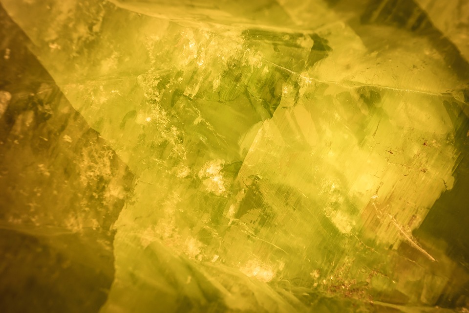
Mineralogical investigation Sheep Creek Nb-REE carbonatite veins, southern Ravalli County, Montana
Chris Gammons
Carbonatite vein-dikes near Sheep Creek in extreme SW Montana have a complex mineralogy that is locally rich in REE minerals (e.g., monazite, ancylite, allanite, REE-F-carbonates) and Nb minerals (e.g., columbite, aeschynite, baotite) in a matrix of calcite, dolomite, quartz, and barite, with accessory apatite, sulfides, and Fe-oxides (magnetite, hematite). Sulfide minerals include pyrite, pyrrhotite, chalcopyrite, cobaltite, and siegenite. The REE profile shows strong enrichment in light REE, similar to carbonatite deposits worldwide. The understudied Sheep Creek deposits belong to a belt of rare metal deposits and alkaline intrusive complexes that trends along the Idaho-Montana border north into the British Columbia Alkaline Province.
Antimony a strategic metal and USAC
John Lawrence
Antimony is a strategic metal that is used to harden lead alloys in bullets, lead acid batteries and other alloys. Antimony oxide is used as a flame retardant in most plastics, many textiles, and as a catalyst in PET. Sodium antimonate is used as a flame retardant in plastics, as a fining agent in glass and as an opacifier. Antimony trisulfide is used in primers for all center-fired ordnance and as a lubricant in friction brakes on aircraft and vehicles. During World War II, the War Department received antimony from the Stibnite Hill Mine (now owned by USAC), the Sunshine Mine and the Yellow Pine District both in Idaho. They could not keep up with the demand, and they ended up buying the bulk of the antimony from three mines in Mexico, the Wadley, Soyatal, and Guadalupe. Following the war, the U. S. Government bought 40,000 tons of antimony metal primarily from the Wadley smelter to create a strategic stockpile. By 2003, all of the metal had been sold from the strategic stockpile. Approximately 92% of all the antimony in the world is supplied by the Chinese. China is the main supplier of antimony trisulfide. This has placed the United States in a very vulnerable position.
USAC began mining and smelting the ore from the Stibnite Hill Mine in Montana in 1969 and continued until 1983 when prices forced its closure. According to the U. S. Geological Survey, the mine production and reserves were estimated at 15,400 metric tons or 33,950,840 pounds of antimony. After the mine closed in 1983, smelter operations continued with raw materials from North America and around the world, and has now become one of two significant antimony smelters in North America (the other smelter is owned by USAC in Mexico). USAC produces all of the four strategic products. The company has developed the technology to remove impurities such as arsenic, lead, bismuth and recover precious metals.
To become a viable supplier of antimony, USAC had to have its own mine reserves. The Company attempted to reopen the Stibnite Hill Mine, but new permitting requirements pre-empted the plans. USAC turned to Mexico where it had previously mined antimony. Ironically, USAC now has the three top producing Mexican Mines that had produced during World War II. All of them are classic Mexican manto deposits. Wadley produced 57,613 tons by 1943 and has produced an estimated 25,000 tons since that time. Soyatal had produced 25,630 tons by 1943 and probably another 20,000 tons since that time. Sierra Guadalupe has no recorded production but its production is comparable to either of the other two deposits. All three properties were mined and smelted by the Cookson Group of England which changed ownership many times and ended up as Great Lakes Chemical.
A case study of tailings impoundment permitting under the new Montana TSF statute
Mark Thompson,Vice President of Environmental Affairs Montana Resources, LLP, Butte, Montana
Recently Montana Resources, LLP (MR), the operator of a copper and molybdenum mine in Butte, MT, received a permit to increase storage capacity in the Yankee Doodle Tailings Impoundment (YDTI). This was the first permit issued by MDEQ where the applicant followed the new Montana TSF statute. The statute is rigorous and involves a third party Engineer of Record and an Independent Review Panel of experts. The presenter will discuss the engineering aspects of the application, the new TSF statute, community involvement and the lessons learned through the permitting process.
An update on the Black Butte Copper Project
Jerry Zeig
Text will come soon !!!
Top of porphyry exploration model
George Brimhall
The intent of this work on orbicular alteration is augmenting knowledge of the distal and upper reaches of the porphyry copper paradigm to help support the transition to deep porphyry copper exploration. We describe low-grade disseminated chalcopyrite zones with orbicular representing a cupola at the upper and outer edge of hydro-fractured stockworks where advective flow slowed and spherical actinolite-calcite-titanite orbs formed by diffusion. Orb alteration makes this subtle physical boundary feature macroscopically visible and contributes a powerful new mapping tool in lithologies where orbs are likely to form in sedimentary and other wall rocks with connected pore space allowing intergranular diffusion. In comparison to strongly advective flow vein systems with planar, vein-parallel wall rock alteration zones like Mainstage Butte veins, distal orb growth involved alteration fronts that are functionally wrapped into 1 to 3 cm diameter spheres at crack tips forming nested semi-spherical reaction fronts that slowly migrated outwards with inner reaction fronts replacing outer fronts. Using the Tera-Wasserburg method we determine a U/Pb SHRIMP date of hydrothermal titanite of 70.7 million years which is similar to the plutonic age range of the Boulder and Pioneer batholiths thus eliminating concern that orbs are merely a strange regional metamorphic effect. Similarly, this new age date supports the hydrothermal origin of the orbs which alter many different rock formations and are axially-symmetrically-aligned with respect to vein gossans, breccias, and felsic plutons at the center of the zoning pattern. Furthermore, the geological normality of orbicular alteration is further established by describing the close geochemical conditions of the titanite-ilmenite-chalcopyrite assemblage with Potassic alteration and early high-temperature copper mineralization. Radiometric dating of titanite in orbs assists in targeting large deep porphyry copper deposits during early exploration through (1) establishing the geochronological context and (2) properly interpreting the orbicular zonation as the exterior of the system's fracture pattern, thus providing a bulls eye to focus follow up exploration of this cupola.
Nature of the hydrothermal system at the Hog Heaven mine, northwestern Montana as revealed from ore mineralogy, fluid inclusions, and stable isotopes
Ian Kallio
Hog Heaven is a high-sulfidation epithermal deposit in northwestern Montana that is unusually rich in Ag-Pb-Zn-Ba and relatively poor in Cu-Au. Early enargite-pyrite-alunite mineralization was overprinted by Ag-Pb-Sb-Bi sulfosalts and late sphalerite-galena-barite. Fluid inclusions in barite are low salinity (0.5-3.9 wt% NaCl) and relatively low temperatures (168-252 C). Sulfur isotope geothermometry gives T = 226 to 304 C. Hog Heaven sulfide and sulfate minerals are isotopically heavy, suggesting assimilation of S from the Belt Supergroup.
THE PROCESSING AND RECYCLING OF GARNET TAILINGS FOR RECOVERY AND MASS REDUCTION PURPOSES
Courtney Young1, Avimanyu Das1, Gary Wyss2, *Matt Egloff3 and Peter Rossiter4
1Metallurgical and Materials Engineering, Montana Tech, Butte, MT 59701
2Center for Advanced Mineral & MetallurgicalProcessing, Montana Tech, Butte, MT 59701 Center for Advanced Mineral & MetallurgicalProcessing, Montana Tech, Butte, MT 59701
3Civil Engineering, Montana Tech, Butte, MT 59701
4GMA Garnet, Alder, MT 59710
Recycling of tailings from a garnet processing plant was investigated for two purposes: (1) recover the garnet lost during their operations, and (2) investigate ways to use the resulting tailings and thereby reduce their tailings footprint. Characterization and analysis of the original tailings by XRD and SEM/MLA contained ~15% almandine garnet with considerable scope for recovery. Results also indicated that ~15% of the material was biotite mica. Successive testing with gravity and magnetic separations showed that a garnet concentrate of 80% purity and 15% recovery could be obtained with partial comminution. Further testing showed that the mica could be reduced to ~5% with additional gravity and magnetic separations. The final product was successfully used to make concrete and mortar. The garnet recovery process would reduce the tailings by ~15% and the mica removal process would reduce the tailings by another ~20%.
* Presenter
Merging historical data with Google Earth and ArcGIS from historic mine surveys, Butte, MT
Tony Roth, Montana Bureau of Mines and Geology, Butte, Montana
Tony will discuss how merging historical data with current technology (Google Earth and ArcGIS) can be resourceful not only in Butte but throughout Montana with subsidence issues due to underground mining. I will also discuss how we are working with local county officials to help identify possible hazard locations and follow with discussing our current NGGDPP grant that is allowing us to scan a small portion of the Butte Stope Book collection.
LATE CRETACEOUS TO EARLY EOCENE LAMPROPHYRIC TEXTURAL AND PYROXENE MINERAL CHEMISTRY VARIATION FROM CALC-ALKALINE SUBDUCTION RELATED MAGMATISM AND THE CENTRAL MONTANA ALKALIC PROVINCE
Jacob A McCane, John Ridley Department of Geosciences, Colorado State University, Fort Collins, CO 80523
Late Cretaceous and early Eocene lamprophyric rocks were sampled and analyzed to determine textural and pyroxene mineral chemistry variations from calc-alkaline subduction related magmatism and the Central Montana Alkalic Province (CMAP) of Montana. Porphyritic pyroxene macrocrysts display resorption during growth, spongy texture within the core and rims, and exhibit complex zonations. Biotite and phlogopite, within the groundmass and as large macrocrysts, display differing zonations, and are often bent or strained. Cretaceous samples analyzed originate from Bull Mountain Range, just north of the Golden Sunlight Au-Ag-telluride deposit, and CMAP samples originate from the Highwood Mountains, the Crazy Mountains, and the Yogo sapphire lamprophyre dyke. Understanding the petrogenesis of these bizarre, potassium rich rocks could aid in field exploration of future economic deposits. There are three competing proposals and petrogenetic models tested in this study. The mantle metasomatism model after the work of Rock (1984) proposed that lamprophyres originate from low degrees of partial melting of volatile rich metasomatized mantle. The hybridization model by Prostka (1973) interprets lamprophyres to be the product of hybridization between syenitic and gabbroic magmas. The third model after Cogne (1962) surmises an origin from the mixing of mafic and felsic components through selective diffusional exchange. Petrographic textural features and analysis coupled with a mineral chemistry study with emphasis on pyroxenes aims to find which model is best suited for lamprophyric rocks from the CMAP. Spongy texture within pyroxenes is interpreted as evidence for disequilibrium of pyroxene within an evolving magma. The analytical traverses of pyroxenes in this region display normal, reverse, and inverse zoning. Patchy zoning and concentric zoning is common within the same crystal, thus a complex history of magma mixing, mingling, and hybridization is captured within pyroxene textural and zonal compositional changes.
Nature and implications of breccias at the lamprophyre-hosted sapphire deposit, Yogo
Tracey Cotterell, John Ridley
Department of Geosciences, Colorado State University, Fort Collins, CO 80523
Sapphires in the lamprophyre dike at Yogo are some of the finest in the world and their origin has not been fully constrained. Sporadic breccias associated with the dike that appear to be spatially related to sapphires have been noted, but not evaluated and may play a role in the generation of sapphires. The objectives of the project are (1) to determine the origin and mode of formation of different types of breccias and their clasts in the Yogo dike and (2) to test the relationships between sapphires and breccia types and different phases of the dike rock. Field observations, sample collecting and preliminary geochemical data suggests that there are two types of breccias in the area. The first is a paleokarst breccia in the host Madison Limestone which ranges from yellow to orange and is clast supported with very little matrix. The matrix is composed of a mixture of clays and iron oxides, while the clasts are a combination of coarse sand to boulder sized, yellow to grey limestone with minor coarse sand to pebble sized red siltstone, probably derived from the overlying Kibbey Formation. Paleokarst breccias in the area are found as limestone spires, irregular shaped bodies up to 200 ft tall and 50 ft wide, and semi- to unconsolidated sediment cones. The second breccia type has been interpreted as paleokarst as well, but differs in that it is deep orange to red in color, semi-consolidated to unconsolidated, and is generally matrix supported with clasts sizes ranging from coarse sand to boulder. These breccias have irregular shaped “blobs” of dike rock incorporated into them and have a higher concentration of red siltstones and shales. The incorporation of magma into the poorly consolidated paleokarst breccias may be evidence of magmatic brecciation or the result of magma intruding into the breccia. No textural or mineralogical evidence has been found to suggest hydrothermal brecciation occurred. The main body of the lamprophyre has abundant lower crustal xenoliths, which exhibit alteration rims and very few xenoliths of the Madison Limestone have been incorporated into the dike. Two phases of the dike have been identified, one coarser grained and more susceptible to weathering and the other finer grained with no obvious weathering pattern.
Lodging
Some Hotel Price recommendations
Hotel Finlen
Business Rate Q - $90,K/2Q - $100
Clarion Copper King Montana Tech
S/D $99
Fairfield Inn MBMG Symposium
S/D $109
Holiday Inn Express Montana Tech
K/2Q -- $113.90
Hampton Inn MBMG Symposium
S/D -- $94 (Free Shuttle)
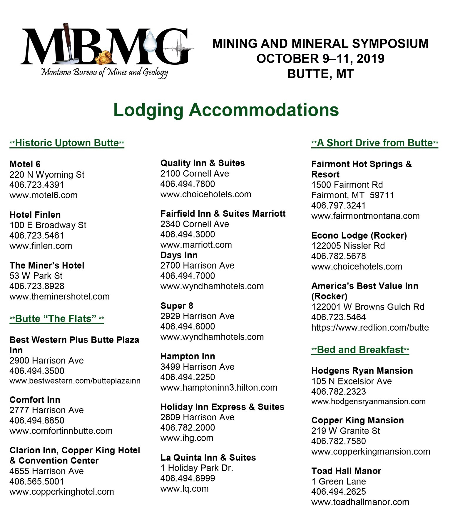
For a map of hotels and links to their websites, please click on the Trip Advisor link below.
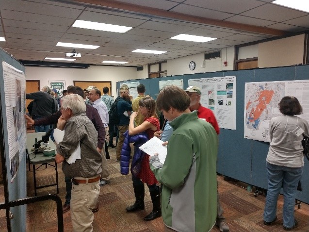
Poster Session
2019 Mining and Mineral Symposium October 9-11, 2019 Butte, Montana
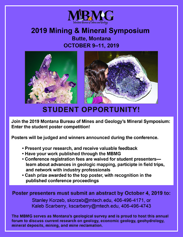
Posters allow for informal, one-on-one or small group discussions with the presenter about the issue, problem, project, or research addressed in the poster. Posters present an opportunity for researchers to present their information and receive valuable feedback from Symposium participants.
SUBMISSION CRITERIA AND REQUIREMENTS:
Biography-
The presenter’s name and a short biography, including your first and last name, your current employment position or class standing (if a student) and major, your areas of professional interest, your future professional or educational goals.
Key Poster Elements-
Poster Title: The title should clearly identify the content of the poster and abstract. Capitalize the first letter of each word in the title, except prepositions and articles.
Set-Up: The poster session location is the Big Butte Room in the Montana Tech Student Union Building. Posters may be set up Thursday, October 11 from 9:00 a.m. – 4:00 p.m. Each poster area will consist of one 4-ft high x 8-ft wide poster board on which to mount presentation information, and one 2-ft x 6-ft material table, provided by the MBMG.
Software: Since Microsoft Word does not have page sizes appropriate for posters, we recommend that you use PowerPoint, Microsoft Publisher, or Adobe InDesign, depending on your familiarity with the software and what is available.
Presenters will retrieve their posters and any supplemental materials at the session’s end. Any posters and materials remaining after 6:00 p.m. will be recycled.
Requirements: All presenters:
- Are required to attend the symposium and be present through the entire Poster Session;
- Are responsible for expenses incurred for their presentation, such as poster production and shipping;
- Will receive paid registration to the entire Symposium (excludes registration for the Friday Banquet and Saturday Field Trip; separate registration and fees apply to these events).
Helpful Resources:
10 Tips for an Effective Poster Presentation
- Keep your poster organized: Include Abstract, Introduction, Methods, Results, Discussion. Posters should flow visually to aid reading.
- Consider poster size: Figure out how much you have to say, and how much space you need. Avoid a cluttered poster.
- Have your poster finished early: You need to have it printed before you reach the workshop, and you want time to proofread.
- Be direct and concise: Deliver your message needs quickly. Most people spend between 3 -5 min. at a poster.
- Think carefully about fonts: Novelty and script fonts are hard to read. Choose appropriate fonts at an appropriate size.
- Think carefully about color: Think carefully about background and font colors. Keep the color scheme simple.
- Keep your poster balanced: Too much of any element in one place is detrimental. Balance the text with the images.
- Don’t disappear: You need to stay by your poster. Be there to promote your work!
- Will receive paid registration to the entire Symposium (excludes registration for the Friday Banquet and Saturday Field Trip; separate registration and fees apply to these events).
- Be prepared for questions: Questions demonstrate interest! Take time to think about the type of questions that you may be asked to help prepare for discussing your work confidently.
Additional Resources on Effective Presentations:
- Do’s and Don’ts of Poster Presentation by Steven M. Block
- Poster Presentation Size Options
- Making Effective Scientific Presentations by Gary Lewis
- No More Lousy PowerPoint Slides by Eric S. Cheney
Abstract- Key Elements
Abstract Summary Statement (250-word limit): This statement should briefly summarize your research with key points highlighted. It should provide a basis for discussion and interaction with participants and evaluators.
Credits and Footnotes: Note each author separately and identify whether the individual is the primary author or a coauthor. Provide each author’s name and organization.
Special Events
WEDNESDAY October 9th - Elkhorn Field Trip
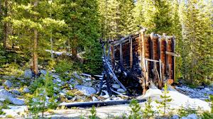
Elkhorn Field TripTravel north of Butte e to the Elkhorn mining district and examine gold skarn mineralization and the remaining town of Elkhorn.Learn the area’s unique history and geology. There will be opportuni es to collect vesuvianite, axinite, and other minerals related to skarn deposits.
INFORMAL MEET AND GREET Following the field trip,enjoy the informal Meet & Greet at the Butte Brewery.
Thursday, October 10th
Oral presentations (including lunch) will be followed by an evening no-host bar followed by a Poster Session at Montana Tech.
Friday, October 11th
Enjoy oral presentations, lunch (on your own), and lab tours followed by an evening Map Chat at the Butte Brewery. Sample great beers from the Butte Brewing Company, meet our MBMG geologists, and learn about their current mapping projects. Bring your mineral samples and try to stump our geologists!