Boulder River Valley
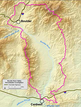
It is believed that the alluvial aquifer of the Boulder River provides baseflow to the Boulder River. In its current state, the Boulder River often runs dry in the late summer, eliminating the ability to irrigate for all but the most senior water rights holders. As such, there are concerns that continued groundwater development in the watershed will further diminish water supplies. There has also been interest in assessing the feasibility of using managed aquifer recharge to supplement late summer flows. This project evaluates these issues within the Lower Boulder River Watershed (USGS Watershed 1002000605). This watershed has an area of approximately 377 square miles, and extends from the town of Boulder to Cardwell. The Boulder River flows into the Jefferson Slough just above the confluence of Jefferson Slough and the Jefferson River. The focus of the study is the alluvial aquifer along the Boulder River; however, information from the uplands is also needed to understand the sources of water contributed to the alluvial aquifer.
Project Scope
This GWIP study examines the interaction between the river and the aquifers in the valley through the following tasks:
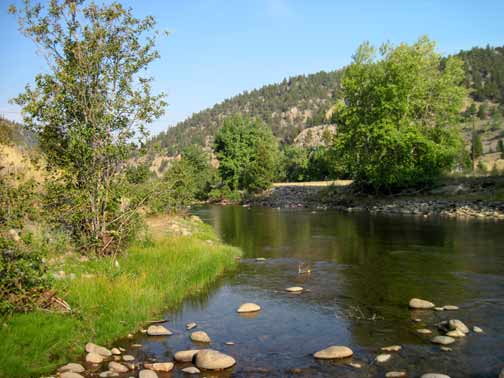 Boulder River
- Collect geologic and hydrologic data to quantify the water systems
- Document the quality of the groundwater and surface waters in the study area
- Calculate the flux of water moving between the alluvium and the river
- Model the magnitude of impacts that would be expected from existing and potential housing developments in the watershed
- Evaluate the potential for increasing water availability through the use of managed recharge
Project Duration: July 2011-December 2015
GWIP Personnel Assigned:
Andrew Bobst – Team Leader/Hydrogeologist
406-496-4409 (office)
406-490-8891 (cell)
 abobst@mtech.edu
Luke Carlson – Student Assistant
John Anderson – Student Assistant
Project Factsheet(pdf file)
Recent Presentations:
- January 2015 - Jefferson County Commissioners — An Overview of the Boulder River Groundwater Investigation
- October 2012 – Cardwell Public Meeting — Boulder River Valley Groundwater Investigation
Publications and Reports:
Interpretive Report
MBMG 682 — Hydrogeologic Investigation of the Boulder Valley, Jefferson County, MT
Project data available here:
http://mbmggwic.mtech.edu/sqlserver/v11/menus/menuProject.asp?mygroup=GWIP&myroot=BWIPBR&ord=1&
In the News
Boulder Monitor – April, 2012
Contact information :
- Where to find us in Butte and Billings
- for general GWIP program information
Ginette Abdo
or 406.496.4152 - for general MBMG information
Cathy McKillips
or 406.496.4167