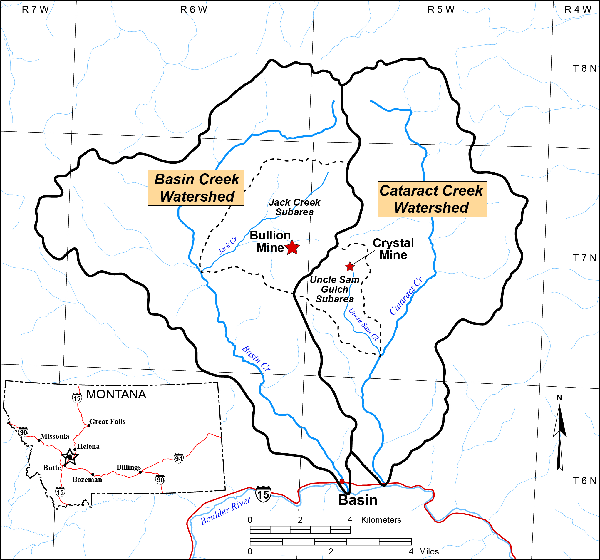
Basin Watershed
- Basin mining district Superfund site
- 300 abandoned hard rock mine sites in 77-square-mile watershed
- The Bullion and Crystal Mines are the two major threats to surface-water quality
Ted Duaime Hydrogeologist—Assistant Professor
(406) 496-4157 | Email
Gary Icopini Hydrogeologist—Professor
(406) 496-4841 | Email
Steve McGrath Geochemist—Assistant Professor
(406) 496-4157 | Email
Jackson Quarles Hydrogeologist—Professional Scientist
Email
John Roitz Water Resource Specialist
Email
Matthew Vitale Hydrogeologist—Professional Scientist
Email
Office locations in Butte and Billings
Bullion Mine Site
- 1897–1974 mining of gold, silver, copper, lead, and zinc
- Mined on three levels; the main adit extended about 4,500 ft to the east along the mineralized structure
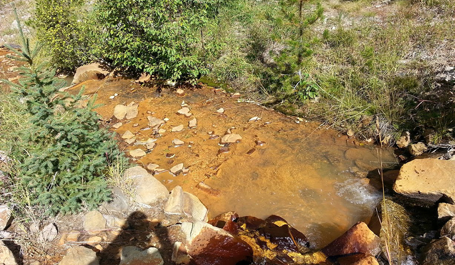
- Surface water and groundwater infiltrate through the fractured bedrock into the mine workings
- Acid mine drainage (lower adit) is the main source of impact on Jack Creek, which is a tributary to Basin Creek
- Elevated arsenic and metals are found in sediment at the discharge to Jack Creek
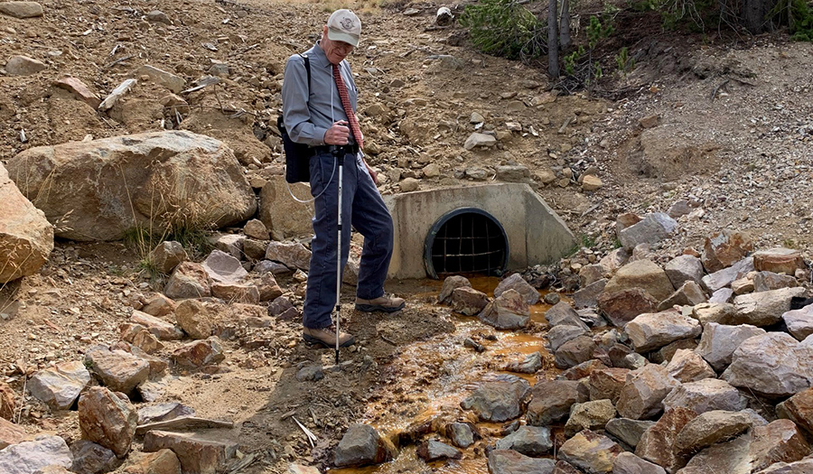
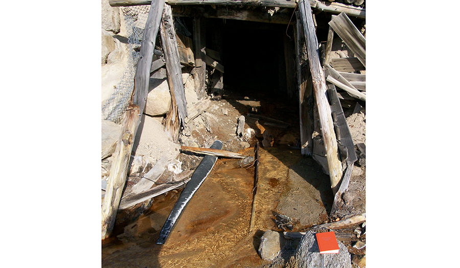
Upper Bullion Mine Adit—Dick Sloan, DEQ Project Manager
Upper Bullion Mine Adit
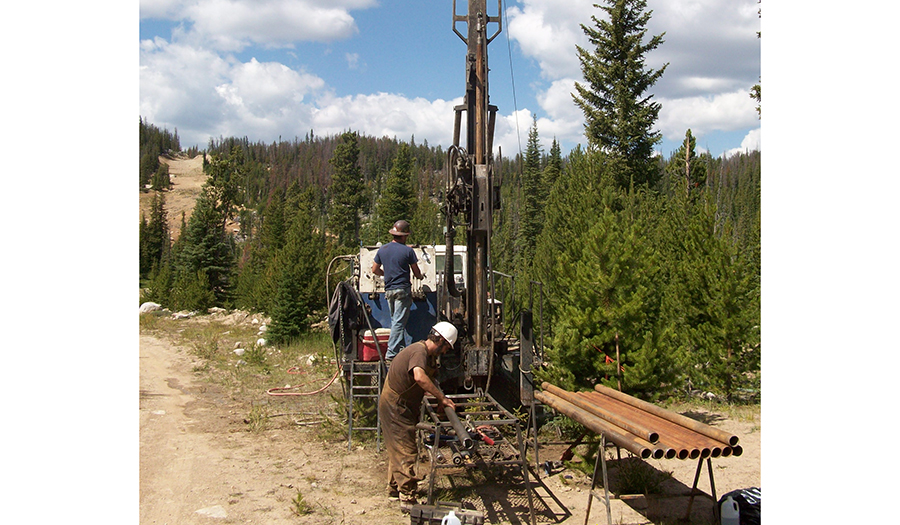
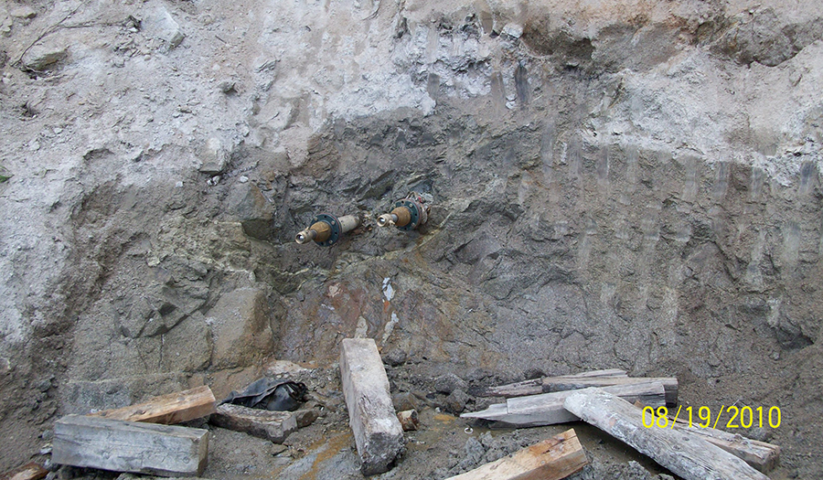
Drilling and installation of well into collapsed Bullion Mine Adit
Crystal Mine Site
- Located at the head of Uncle Sam Gulch within the Cataract Creek drainage
- 1883–1984 Mining of copper, lead, and zinc ore, which was generally shipped to Basin or East Helena for processing
- Waste rock, tailings, and sediment are sources of arsenic and metals to Uncle Sam Gulch Creek
- Surface water and groundwater infiltrate into mine workings and create about 25-40 gpm of acid mine drainage
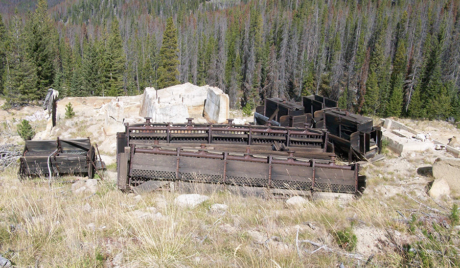
Remnants of old mill equipment—Crystal Mine
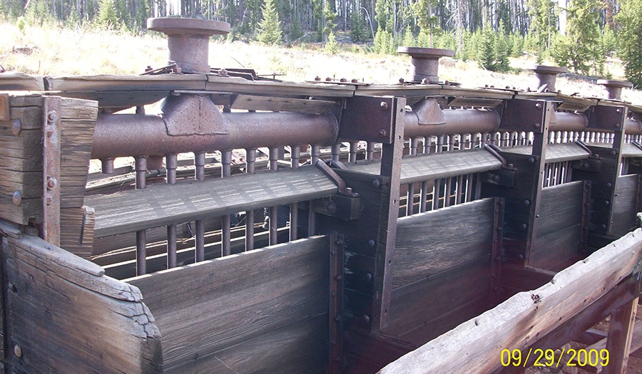
Remnants of old mill equipment—Crystal Mine #2
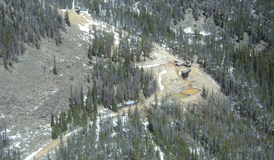
Crystal Mine aerial photo, May 2012
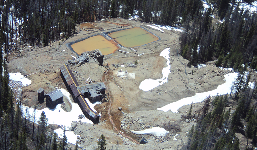
Crystal Mine aerial photo showing ponds, May 2012
Crystal Mine Open Adit #2, Sept 2009
Crystal Mine flume downstream of adit discharge
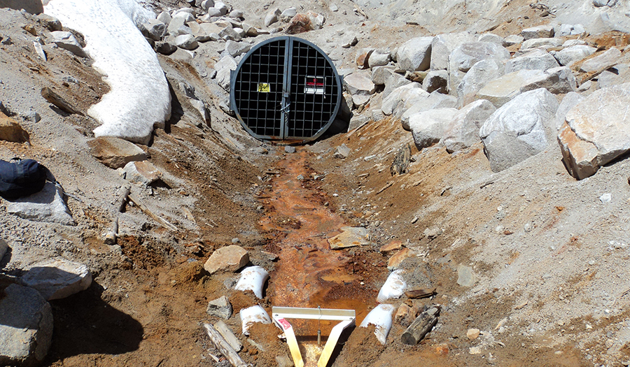
Crystal Mine security grate, flume, May 2012
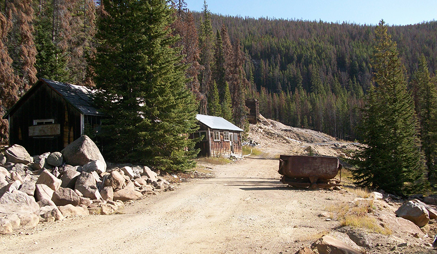
Crystal Mine buildings, Sept 2009
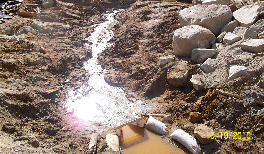
Crystal Mine drain holes, Aug 2010